File:Bay of Kaštela, Croatia OpenStreetMap.png
Jump to navigation
Jump to search
Size of this preview: 800 × 464 pixels. Other resolutions: 320 × 186 pixels | 640 × 372 pixels | 1,068 × 620 pixels.
Original file (1,068 × 620 pixels, file size: 686 KB, MIME type: image/png)
Captions
Captions
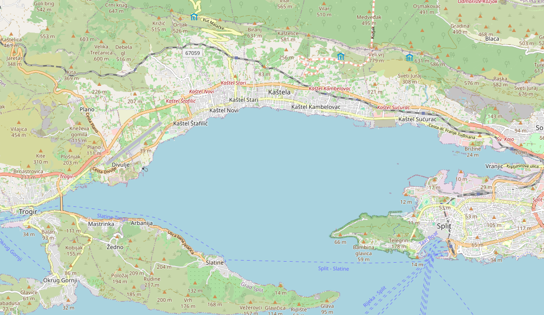
Bay of Kaštela, Croatia
Summary
[edit]
| Description |
English: Bay of Kaštela, Croatia |
| Date | |
| Source | openstreetmap.org |
| Author | OpenStreetMap contributors |
Licensing
[edit]
| Description |
This map of Bay of Kaštela, Croatia was created from OpenStreetMap project data, collected by the community. This map may be incomplete, and may contain errors. Don't rely solely on it for navigation. |
|||
| Date | (see file history) | |||
| Source | openstreetmap.org | |||
| Creator |
OpenStreetMap contributors |
|||
| Permission (Reusing this file) |
OpenStreetMap data is available under the Open Database License (details). Map tiles are licensed under the Creative Commons Attribution-ShareAlike 2.0 license (CC-BY-SA 2.0).
This file is licensed under the Creative Commons Attribution-Share Alike 2.0 Generic license.
|
|||
| Georeferencing | If inappropriate please set warp_status = skip to hide. |
File history
Click on a date/time to view the file as it appeared at that time.
| Date/Time | Thumbnail | Dimensions | User | Comment | |
|---|---|---|---|---|---|
| current | 22:06, 18 December 2023 | | 1,068 × 620 (686 KB) | Argo Navis (talk | contribs) | Uploaded own work with UploadWizard |
You cannot overwrite this file.
File usage on Commons
There are no pages that use this file.
File usage on other wikis
The following other wikis use this file:
- Usage on hr.wikipedia.org
- Crkva sv. Jurja na Putalju
- Crkva sv. Ivana Krstitelja u Kaštel Starom
- Crkva sv. Jurja od Raduna
- Crkva sv. Jurja od Žestinja u Kaštel Novom
- Crkva sv. Petra u Kaštel Novome
- Groblje na Stupima
- Hotel Palace s vrtom u Kaštel Starome
- Crkva Uznesenja BDM u Kaštel Lukšiću
- Modul:Location map/data/Hrvatska Kaštelanski zaljev
- Modul:Location map/data/Hrvatska Kaštelanski zaljev/doc