File:Bayou des Allemands.jpg
Ir a la navegación
Ir a la búsqueda
Tamaño de esta previsualización: 800 × 533 píxeles. Otras resoluciones: 320 × 213 píxeles | 640 × 427 píxeles | 1024 × 683 píxeles | 1500 × 1000 píxeles.
Archivo original (1500 × 1000 píxeles; tamaño de archivo: 333 kB; tipo MIME: image/jpeg)
Leyendas
Leyendas
Añade una explicación corta acerca de lo que representa este archivo
| Descripción |
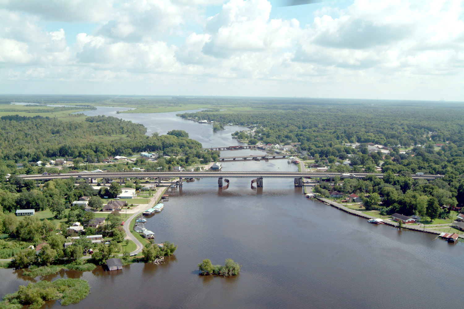
English: Bayou des Allemands and the town of Des Allemands, Louisiana, USA. The bayou is the boundary between St. Charles Parish (right) and Lafourche Parish (left). The three bridges crossing the bayou are (farthest to closest): A railroad bridge, Louisiana State Route 631, and U.S. Route 90. View is to the north. |
|||
| Fecha | ||||
| Fuente |
U.S. Army Corps of Engineers Digital Visual Library Image page Image description page Digital Visual Library home page |
|||
| Autor | Lane Lefort, U.S. Army Corps of Engineers | |||
| Permiso (Reutilización de este archivo) |
|
|||
| Localización | Des Allemands, Louisiana, USA |
| Posición de la cámara | | Ubicación de esta y otras imágenes en: OpenStreetMap |
|---|
Historial del archivo
Haz clic sobre una fecha y hora para ver el archivo tal como apareció en ese momento.
| Fecha y hora | Miniatura | Dimensiones | Usuario | Comentario | |
|---|---|---|---|---|---|
| actual | 22:41 7 abr 2007 | | 1500 × 1000 (333 kB) | DanMS (discusión | contribs.) | {{Information | Description = {{en|Bayou des Allemands and the town of Des Allemands, Louisiana, USA. The bayou is the boundary between St. Charles Parish (right) and Lafourche Parish (left). The three bridges crossing the bayou are (farthest to closes |
No puedes sobrescribir este archivo.
Usos del archivo
Las siguientes páginas usan este archivo:
Uso global del archivo
Las wikis siguientes utilizan este archivo:
- Uso en ar.wikipedia.org
- Uso en ca.wikipedia.org
- Uso en ceb.wikipedia.org
- Uso en ce.wikipedia.org
- Uso en cy.wikipedia.org
- Uso en de.wikipedia.org
- Uso en en.wikipedia.org
- Uso en es.wikipedia.org
- Uso en fa.wikipedia.org
- Uso en fr.wikipedia.org
- Uso en fy.wikipedia.org
- Uso en it.wikipedia.org
- Uso en lld.wikipedia.org
- Uso en nl.wikipedia.org
- Uso en pl.wikipedia.org
- Uso en pt.wikipedia.org
- Uso en sh.wikipedia.org
- Uso en sr.wikipedia.org
- Uso en th.wikipedia.org
- Uso en tt.wikipedia.org
- Uso en uk.wikipedia.org
- Uso en www.wikidata.org
- Uso en zh-min-nan.wikipedia.org
- Uso en zh.wikipedia.org
Metadatos
Categorías:
- Des Allemands, Louisiana
- U.S. Route 90 in Louisiana
- July 2003 in Louisiana
- Bayous in Louisiana
- Bridges over rivers in Louisiana
- Road bridges in Louisiana
- Girder bridges in Louisiana
- 1960s bridges in Louisiana
- Built in Louisiana in 1961
- Bridges in the United States completed in 1961
- Steel bridges in the United States
- Twin bridges in the United States
- Bridges on U.S. Route 90
- 0.7 kilometers bridges
- Saint Charles Parish, Louisiana in the 2000s
- Lafourche Parish, Louisiana in the 2000s