File:Bayreuth Maxstr 76.jpg
Jump to navigation
Jump to search

Size of this preview: 737 × 600 pixels. Other resolutions: 295 × 240 pixels | 590 × 480 pixels | 944 × 768 pixels | 1,259 × 1,024 pixels | 2,360 × 1,920 pixels.
Original file (2,360 × 1,920 pixels, file size: 1.07 MB, MIME type: image/jpeg)
Captions
Captions
Add a one-line explanation of what this file represents
Summary
[edit]
| Description |
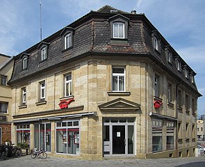
English: Bayreuth Maximilianstraße 76
Deutsch: Bayreuth Maximilianstraße 76. Zweigeschossiger Sandsteinquaderbau mit Mansarddach, zweite Hälfte 18. Jahrhundert.
|
||
| Date | |||
| Source | Own work | ||
| Author | Chianti |
| Object location | | View this and other nearby images on: OpenStreetMap |
|---|
| Copyleft: This work of art is free; you can redistribute it and/or modify it according to terms of the Free Art License. You will find a specimen of this license on the Copyleft Attitude site as well as on other sites. |
File history
Click on a date/time to view the file as it appeared at that time.
| Date/Time | Thumbnail | Dimensions | User | Comment | |
|---|---|---|---|---|---|
| current | 16:34, 28 July 2019 | | 2,360 × 1,920 (1.07 MB) | Chianti (talk | contribs) | {{Information |description ={{en|1=Bayreuth Maximilianstraße 76}} {{de|1=Bayreuth Maximilianstraße 76. Zweigeschossiger Sandsteinquaderbau mit Mansarddach, zweite Hälfte 18. Jahrhundert. {{Baudenkmal Bayern|1=D-4-62-000-255 }} }} |date =2019-07-28 |source ={{own}} |author =User:Chianti }} {{Object location|49.944469|11.571004}} {{FAL}} Category:Maximilianstraße 76 (Bayreuth) |
You cannot overwrite this file.
File usage on Commons
The following page uses this file:
File usage on other wikis
The following other wikis use this file:
- Usage on de.wikipedia.org
- Usage on www.wikidata.org