File:Belgrade bypass.jpg
পরিভ্রমণে চলুন
অনুসন্ধানে চলুন
এই প্রাকদর্শনের আকার: ৬১০ × ৫৯৯ পিক্সেল। অন্যান্য আকারসমূহ: ২৪৪ × ২৪০ পিক্সেল | ৪৮৯ × ৪৮০ পিক্সেল | ৭৮২ × ৭৬৮ পিক্সেল | ১,০৪২ × ১,০২৪ পিক্সেল | ১,৬৫০ × ১,৬২১ পিক্সেল।
মূল ফাইল (১,৬৫০ × ১,৬২১ পিক্সেল, ফাইলের আকার: ৩০১ কিলোবাইট, এমআইএমই ধরন: image/jpeg)
ক্যাপশনসমূহ
ক্যাপশন
এই ফাইল কি প্রতিনিধিত্ব করছে তার এক লাইন ব্যাখ্যা যোগ করুন

|
This transport map image could be re-created using vector graphics as an SVG file. This has several advantages; see Commons:Media for cleanup for more information. If an SVG form of this image is available, please upload it and afterwards replace this template with
{{vector version available|new image name}}.
It is recommended to name the SVG file “Belgrade bypass.svg”—then the template Vector version available (or Vva) does not need the new image name parameter. |


সারাংশ[সম্পাদনা]
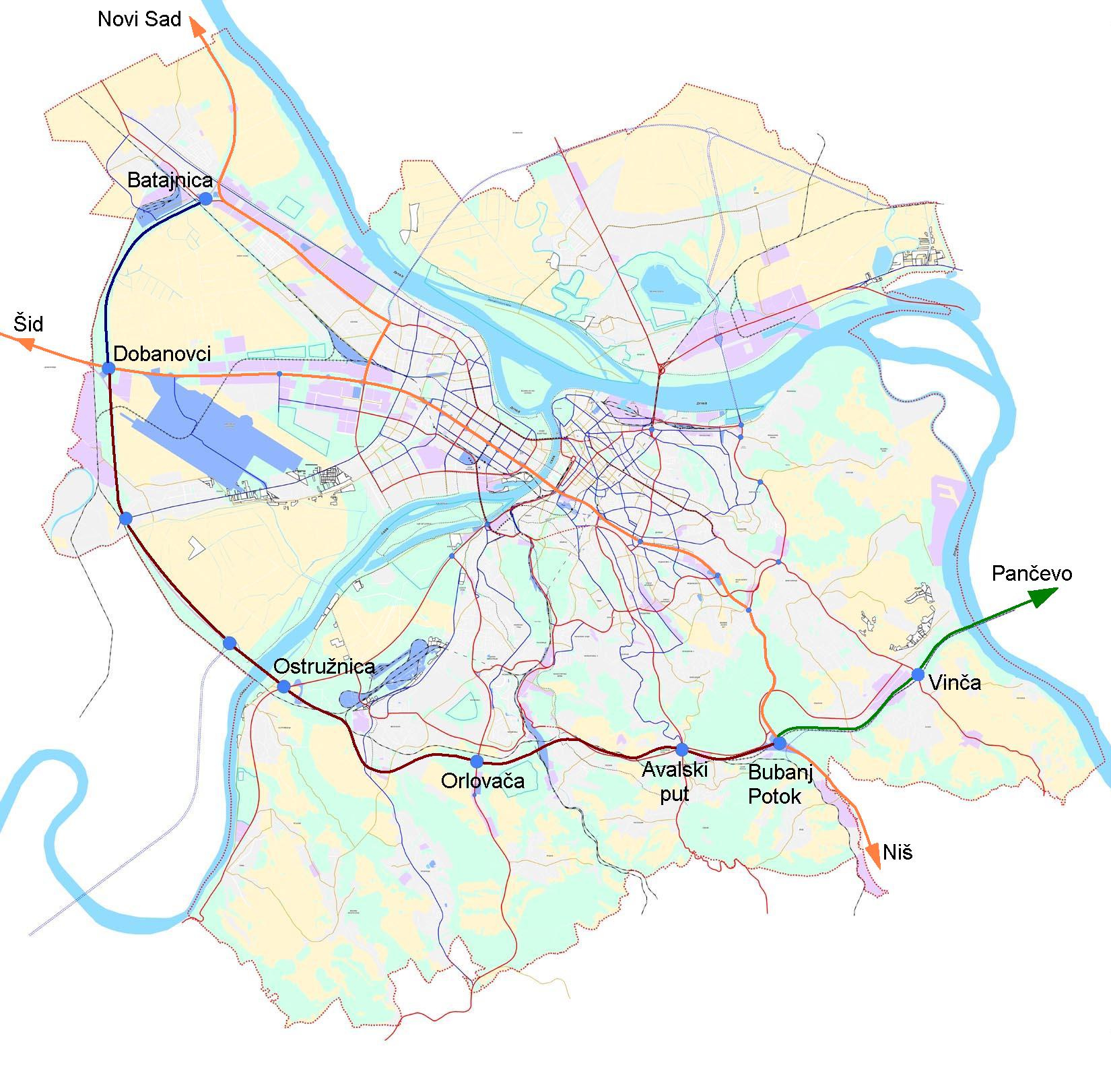
| বিবরণ | Map of Belgrade bypass |
| তারিখ | |
| উৎস |
This file was derived from: |
| লেখক | Duja |
| অনুমতি (এ ফাইলের পুনঃব্যবহার) |
The base image is part of General Urbanist Plan of city of Belgrade, which is {{PD-SerbiaGov}} |
লাইসেন্স প্রদান[সম্পাদনা]
This work is in the public domain because according to the Copyright Law of Serbia (details), "Work is not copyrighted if the work is:
|
 |
ফাইলের ইতিহাস
যেকোনো তারিখ/সময়ে ক্লিক করে দেখুন ফাইলটি তখন কী অবস্থায় ছিল।
| তারিখ/সময় | সংক্ষেপচিত্র | মাত্রা | ব্যবহারকারী | মন্তব্য | |
|---|---|---|---|---|---|
| বর্তমান | ১৪:৩১, ২৩ অক্টোবর ২০০৭ | | ১,৬৫০ × ১,৬২১ (৩০১ কিলোবাইট) | Duja (আলোচনা | অবদান) | {{Information |Description=Map of en:Belgrade bypass |Source=Created by User:Duja, on the basis of http://www.beograd.org.yu/documents/plan2021/03_plan_saobracaj.jpg |Date=2007-10-23 |Author=User:Duja |Permission=The base image is part of Gen |
আপনি এই ফাইলটি প্রতিস্থাপন করতে পারবেন না।
ফাইলের ব্যবহার
নিম্নলিখিত পাতাটি এই ফাইল ব্যবহার করে:
ফাইলের বৈশ্বিক ব্যবহার
নিচের অন্যান্য উইকিগুলো এই ফাইলটি ব্যবহার করে:
- bg.wikipedia.org-এ ব্যবহার
- bn.wikipedia.org-এ ব্যবহার
- de.wikipedia.org-এ ব্যবহার
- de.wikivoyage.org-এ ব্যবহার
- en.wikipedia.org-এ ব্যবহার
- fr.wikipedia.org-এ ব্যবহার
- hu.wikipedia.org-এ ব্যবহার
- sh.wikipedia.org-এ ব্যবহার
- sr.wikipedia.org-এ ব্যবহার
- sv.wikipedia.org-এ ব্যবহার
- tr.wikipedia.org-এ ব্যবহার
- uz.wikipedia.org-এ ব্যবহার