File:Bellin, Jacques Nicolas – Carte des Isles du Cap Verd dressée sur les journaux et les remarques des plus habiles navigateurs, 1746 – BEIC IE8972322.jpg
Jump to navigation
Jump to search

Size of this preview: 774 × 600 pixels. Other resolutions: 310 × 240 pixels | 620 × 480 pixels | 991 × 768 pixels | 1,280 × 992 pixels | 2,560 × 1,984 pixels | 3,846 × 2,980 pixels.
Original file (3,846 × 2,980 pixels, file size: 2.79 MB, MIME type: image/jpeg)
Captions
Captions
Add a one-line explanation of what this file represents
Summary
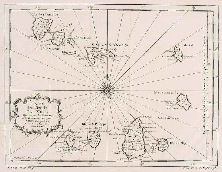
[edit]| Carte des Isles du Cap Verd dressée sur les journaux et les remarques des plus habiles navigateurs | |||||||||||||||||||||||
|---|---|---|---|---|---|---|---|---|---|---|---|---|---|---|---|---|---|---|---|---|---|---|---|
| Author |
Jacques Nicolas Bellin |
||||||||||||||||||||||
| Title |
Carte des Isles du Cap Verd dressée sur les journaux et les remarques des plus habiles navigateurs |
||||||||||||||||||||||
| Publisher |
Didot |
||||||||||||||||||||||
| Description |
Italiano: tavola |
||||||||||||||||||||||
| Language | french | ||||||||||||||||||||||
| Dimensions | height: 230 mm (9.05 in); width: 299 mm (11.77 in) | ||||||||||||||||||||||
| Publication date | 1746 | ||||||||||||||||||||||
| Collection |
|
||||||||||||||||||||||
| Place of publication | Paris | ||||||||||||||||||||||
| Techinique | etching print and burin | ||||||||||||||||||||||
| Source |
|
||||||||||||||||||||||
| Physical item location | Biblioteca del Museo di Storia naturale e dell'Acquario civico di Milano | ||||||||||||||||||||||

Licensing
[edit]
|
This work is in the public domain in its country of origin and other countries and areas where the copyright term is the author's life plus 100 years or fewer. This work is in the public domain in the United States because it was published (or registered with the U.S. Copyright Office) before January 1, 1929. | |
| This file has been identified as being free of known restrictions under copyright law, including all related and neighboring rights. | |
File history
Click on a date/time to view the file as it appeared at that time.
| Date/Time | Thumbnail | Dimensions | User | Comment | |
|---|---|---|---|---|---|
| current | 07:53, 7 May 2024 | | 3,846 × 2,980 (2.79 MB) | Marcella Medici (BEIC) (talk | contribs) | pattypan 22.02 |
You cannot overwrite this file.
File usage on Commons
The following 2 pages use this file: