File:BeringBridge.jpg
Jump to navigation
Jump to search
No higher resolution available.
BeringBridge.jpg (700 × 454 pixels, file size: 78 KB, MIME type: image/jpeg)
Captions
Captions
Add a one-line explanation of what this file represents
| Description |
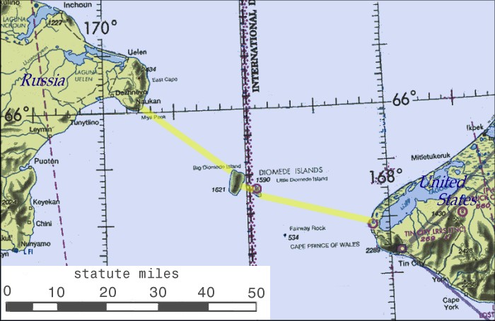
English: Possible routing of International Peace Bridge |
||||||
| Source | Source of basemap: World Aeronautical Chart CC-8, Federal Aviation Administration | ||||||
| Author | Cleaned up and annotated by contributor. | ||||||
| Permission (Reusing this file) |
|
||||||


|
This map image could be re-created using vector graphics as an SVG file. This has several advantages; see Commons:Media for cleanup for more information. If an SVG form of this image is available, please upload it and afterwards replace this template with
{{vector version available|new image name}}.
It is recommended to name the SVG file “BeringBridge.svg”—then the template Vector version available (or Vva) does not need the new image name parameter. |


File history
Click on a date/time to view the file as it appeared at that time.
| Date/Time | Thumbnail | Dimensions | User | Comment | |
|---|---|---|---|---|---|
| current | 16:52, 7 January 2007 | | 700 × 454 (78 KB) | Toyota prius 2~commonswiki (talk | contribs) | == Summary == Possible routing of International Peace Bridge. Source of basemap: World Aeronautical Chart CC-8, Federal Aviation Administration. Cleaned up and annotatated by contributor. == Licensing == {{PD-USGov}} |
You cannot overwrite this file.
File usage on Commons
The following page uses this file:
File usage on other wikis
The following other wikis use this file:
- Usage on bg.wikipedia.org
- Usage on ca.wikipedia.org
- Usage on en.wikipedia.org
- Usage on eo.wikipedia.org
- Usage on es.wikipedia.org
- Usage on fa.wikipedia.org
- Usage on fr.wikipedia.org
- Usage on he.wikipedia.org
- Usage on hu.wikipedia.org
- Usage on id.wikipedia.org
- Usage on it.wikipedia.org
- Usage on nl.wikipedia.org
- Usage on pl.wikipedia.org
- Usage on pnb.wikipedia.org
- Usage on pt.wikipedia.org
- Usage on ru.wikipedia.org
- Usage on sl.wikipedia.org
- Usage on sq.wikipedia.org
- Usage on sv.wikipedia.org
- Usage on tr.wikipedia.org
- Usage on uk.wikipedia.org
- Usage on ur.wikipedia.org
- Usage on www.wikidata.org
- Usage on zh.wikipedia.org