File:Bernkastel BW 2.JPG
Jump to navigation
Jump to search

Size of this preview: 800 × 533 pixels. Other resolutions: 320 × 213 pixels | 640 × 426 pixels | 1,024 × 682 pixels | 1,280 × 853 pixels | 2,560 × 1,705 pixels | 5,743 × 3,826 pixels.
Original file (5,743 × 3,826 pixels, file size: 7.27 MB, MIME type: image/jpeg)
Captions
Captions
Add a one-line explanation of what this file represents
Summary
[edit]
| Camera location | | View this and other nearby images on: OpenStreetMap |
|---|
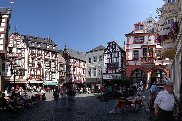
| Description |
Deutsch: Marktplatz in Bernkastel-Kues |
| Date | |
| Source | Own work |
| Author | Berthold Werner |
This panoramic image was created with Autostitch (stitched images may differ from reality).
Licensing
[edit]
| I, the copyright holder of this work, release this work into the public domain. This applies worldwide. In some countries this may not be legally possible; if so: I grant anyone the right to use this work for any purpose, without any conditions, unless such conditions are required by law. |
File history
Click on a date/time to view the file as it appeared at that time.
| Date/Time | Thumbnail | Dimensions | User | Comment | |
|---|---|---|---|---|---|
| current | 16:41, 29 August 2008 | | 5,743 × 3,826 (7.27 MB) | Berthold Werner (talk | contribs) | {{Information |Description={{de|1=Marktplatz in Bernkastel-Kues}} |Source=Eigenes Werk (own work) |Author=Berthold Werner |Date=2008-07-27 |Permission= |other_versions= }} <!--{{ImageUpload|full}}--> Category:Bernkastel-Kues |
You cannot overwrite this file.
File usage on Commons
The following 2 pages use this file:
File usage on other wikis
The following other wikis use this file:
- Usage on cs.wikipedia.org
- Usage on de.wikipedia.org
- Usage on de.wikivoyage.org
- Usage on en.wikipedia.org
- Usage on eo.wikipedia.org
- Usage on it.wikipedia.org
- Usage on nl.wikipedia.org
- Usage on pl.wikipedia.org
- Usage on pl.wikivoyage.org
- Usage on uk.wikipedia.org
- Usage on vi.wikipedia.org