File:Biscayne National Park Map 2009.png
跳转到导航
跳转到搜索

本预览的尺寸:528 × 600像素。 其他分辨率:211 × 240像素 | 423 × 480像素 | 676 × 768像素 | 902 × 1,024像素 | 1,803 × 2,048像素 | 3,391 × 3,851像素。
原始文件 (3,391 × 3,851像素,文件大小:487 KB,MIME类型:image/png)
说明
说明
添加一行文字以描述该文件所表现的内容
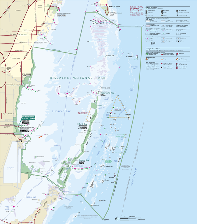
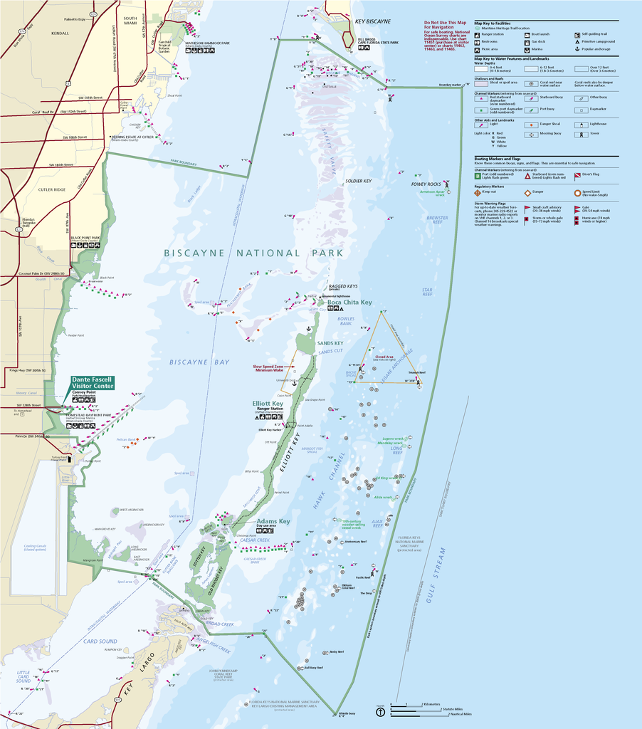
Official National Park Service map of Biscayne National Park, Florida
摘要
[编辑]
| 描述 |
English: Official National Park Service map of Biscayne National Park, Official National Park Service map of Biscayne National Park, Florida. Converted from PDF using Adobe Acrobat X Professional. Original file name:
BISCmap1.pdfFrançais : Carte officielle du parc national Biscayne en Floride |
| 日期 | |
| 来源 | http://hfc.nps.gov/carto/PDF/BISCmap1.pdf |
| 作者 | National Park Service, Harpers Ferry Center |
许可协议
[编辑]
| This image or media file contains material based on a work of a National Park Service employee, created as part of that person's official duties. As a work of the U.S. federal government, such work is in the public domain in the United States. See the NPS website and NPS copyright policy for more information. |
文件历史
点击某个日期/时间查看对应时刻的文件。
| 日期/时间 | 缩略图 | 大小 | 用户 | 备注 | |
|---|---|---|---|---|---|
| 当前 | 2012年11月19日 (一) 19:39 | | 3,391 × 3,851(487 KB) | Acroterion(留言 | 贡献) | {{Information |Description ={{en|1=Official National Park Service map of Everglades National Park, Official National Park Service map of [[:en:Everglades Na... |
您不可以覆盖此文件。
文件用途
以下页面使用本文件:
全域文件用途
以下其他wiki使用此文件:
- de.wikipedia.org上的用途
- en.wikipedia.org上的用途
- en.wikivoyage.org上的用途
- es.wikipedia.org上的用途
- eu.wikipedia.org上的用途
- he.wikipedia.org上的用途
- it.wikipedia.org上的用途
- ru.wikipedia.org上的用途
- tr.wikipedia.org上的用途
- zh.wikipedia.org上的用途