File:Bitola map 1890.jpg
Jump to navigation
Jump to search

Size of this preview: 471 × 599 pixels. Other resolutions: 189 × 240 pixels | 377 × 480 pixels | 604 × 768 pixels | 805 × 1,024 pixels | 1,610 × 2,048 pixels | 3,560 × 4,528 pixels.
Original file (3,560 × 4,528 pixels, file size: 3.29 MB, MIME type: image/jpeg)
Captions
Captions
Add a one-line explanation of what this file represents
Summary
[edit]
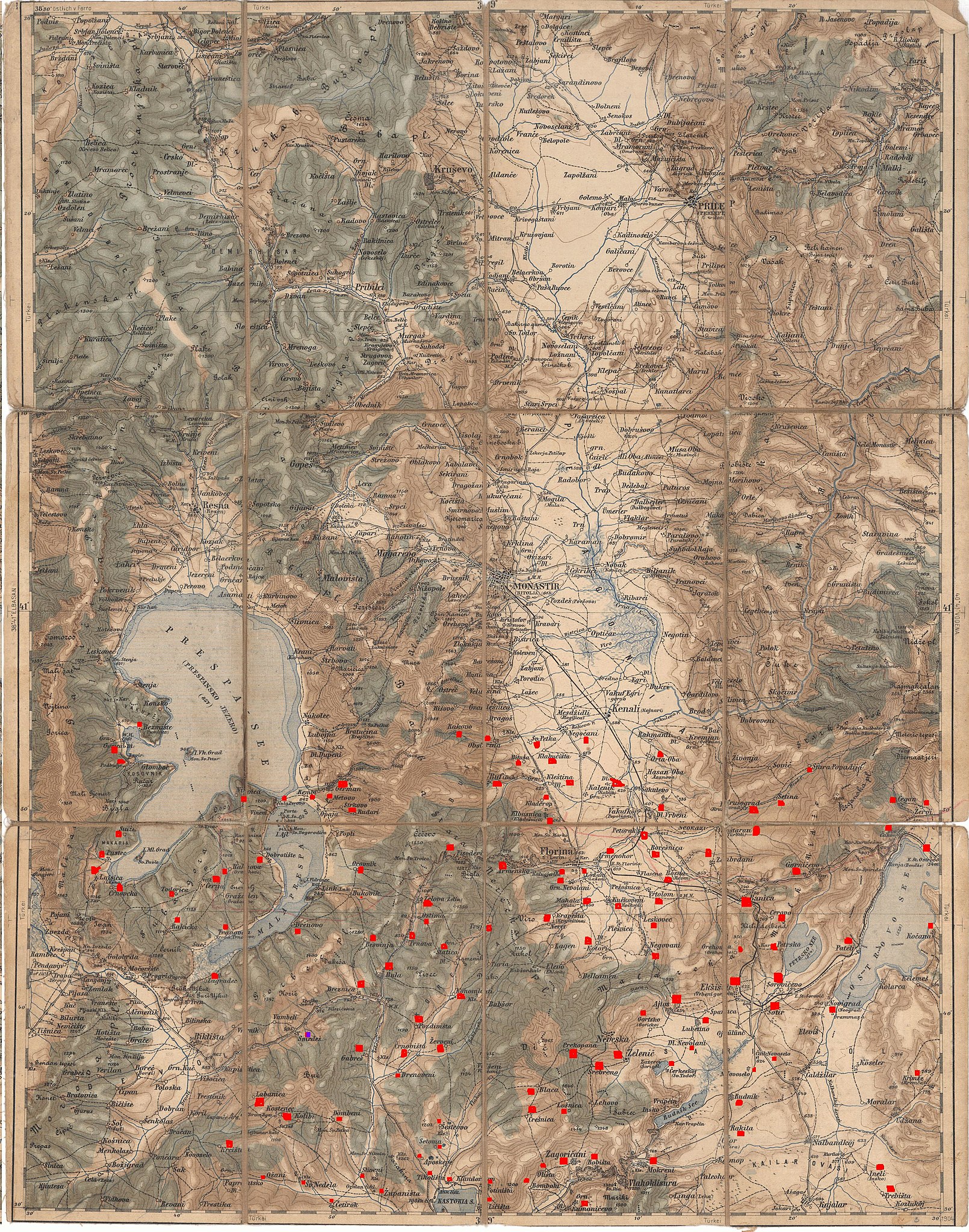
| Description | Pre-World War I "action map" of Monastir (Present day Bitola, Macedonia) and its environs. This map series is useful to scholars because it reflects the original pre-war toponymns in precise detail. |
| Date | circa 1890 |
| Source | My own scan |
| Author | Artaria & Co. Publishing |
| Permission (Reusing this file) |
Public Domain |
Licensing
[edit]
|
This work is in the public domain in its country of origin and other countries and areas where the copyright term is the author's life plus 70 years or fewer. | |
| This file has been identified as being free of known restrictions under copyright law, including all related and neighboring rights. | |
File history
Click on a date/time to view the file as it appeared at that time.
| Date/Time | Thumbnail | Dimensions | User | Comment | |
|---|---|---|---|---|---|
| current | 22:38, 2 December 2009 | | 3,560 × 4,528 (3.29 MB) | DraganKitanoski (talk | contribs) | This are the Macedonian Vilages today in Ditiki Makedonia and in Liqenas areas in Greece and Albania. |
| 00:29, 24 January 2008 |  | 3,560 × 4,528 (4.19 MB) | Tlay (talk | contribs) | == Summary == {{Information |Description= Pre-World War I "action map" of Monastir (Present day Bitola, Macedonia) and its environs. This map series is useful to scholars because it reflects the original pre-war toponymns in precise detail. |Source= My ow |
You cannot overwrite this file.
File usage on Commons
There are no pages that use this file.
File usage on other wikis
The following other wikis use this file:
- Usage on el.wikipedia.org
- Usage on fr.wikipedia.org
- Usage on mk.wikipedia.org