File:BlankMap-World-Flattened.svg
Zur Navigation springen
Zur Suche springen

Größe der PNG-Vorschau dieser SVG-Datei: 800 × 406 pixels. Other resoluziuns: 320 × 162 pixels | 640 × 325 pixels | 1.024 × 519 pixels | 1.280 × 649 pixels | 2.560 × 1.299 pixels | 2.754 × 1.397 pixels.
Datoteca originala (datoteca da SVG, grondezza da basa 2.754 × 1.397 pixels, grondezza da datoteca: 1,68 MB)
Bildtexte
Kurzbeschreibungen
Ergänze eine einzeilige Erklärung, was diese Datei darstellt.
Resumaziun[modifitgar]
| Descripziun |
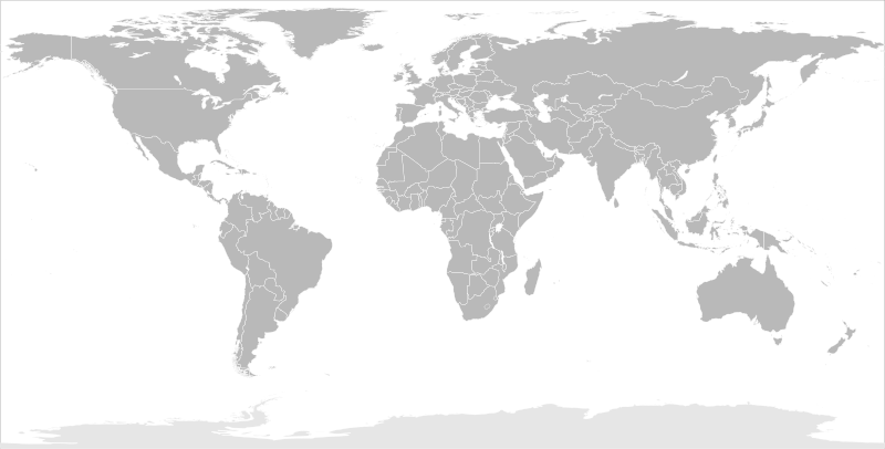
English: Blank political map of the world in modified (flattened) Robinson projection. This image is a sample of output from nugsl-worldmap, a Python script for the manipulation of this map. The script can also produce rotated images, add pinpoint marks at particular geographic coordinates, and produce web pages with clickable areas for specific countries and pinpoint marks.
Note that this map is not equirectangular, and cannot be used as a push-pin map to identify coordinates assuming equal latitude and longitude spacing. A map using the equirectangular projection is available at File:BlankMap-World6-Equirectangular.svg. |
| Data | (for the script only) |
| Funtauna |
http://www.law.nagoya-u.ac.jp/en/appendix/software/worldmap/ Refactored from Image:BlankMap-World.svg, q.v. |
| Autur | Frank Bennett |
| permissiun (Weiternutzung dieser Datei) |
The map data manipulated by the script is in the public domain. The raw output of the script, including the file shown here, is also in the public domain. |
| Andere Versionen |
Derivative works of this file:
|
| SVG‑Erstellung |
Licenza[modifitgar]
| Ich, der Urheberrechtsinhaber dieses Werkes, veröffentliche es als gemeinfrei. Dies gilt weltweit. In manchen Staaten könnte dies rechtlich nicht möglich sein. Sofern dies der Fall ist: Ich gewähre jedem das bedingungslose Recht, dieses Werk für jedweden Zweck zu nutzen, es sei denn, Bedingungen sind gesetzlich erforderlich. |
Istorgia da las versiuns
Clicca sin ina data/temps per vesair la versiun da lura.
| data/temp | Maletg da prevista | dimensiuns | Utilisader | commentari | |
|---|---|---|---|---|---|
| actual | 10:44, 20. mars 2014 | | 2.754 × 1.397 (1,68 MB) | Underlying lk (Discussiun | contribuziuns) | fix classes for Soudan and South Soudan |
| 16:01, 16. mars 2013 |  | 2.754 × 1.397 (1,68 MB) | Flappiefh (Discussiun | contribuziuns) | South Sudan added. | |
| 11:47, 14. schan 2008 |  | 2.754 × 1.397 (1,67 MB) | Biercenator (Discussiun | contribuziuns) | Updated to current version of map produced by the script. | |
| 13:22, 19. dec 2007 |  | 940 × 477 (1,99 MB) | Biercenator (Discussiun | contribuziuns) | == Summary == Refactored from en:Image:BlankMap-World6.svg, q.v. This image is a sample of output from [http://gsl-nagoya-u.net/appendix/software/worldmap/ nugsl-worldmap], a Python script for the manipulation and maintenance of this map. The flatt | |
| 15:31, 15. dec 2007 |  | 940 × 477 (2 MB) | Biercenator (Discussiun | contribuziuns) | Refactored from en:Image:BlankMap-World6.svg, q.v. This image might prove useful if you want to change the area shown in the center of the Robinson projection version, since the conversion can be reversed. | |
| 15:18, 15. dec 2007 |  | 940 × 477 (2 MB) | Biercenator (Discussiun | contribuziuns) | == Summary == Refactored from en:BlankMap-World6.svg, q.v. This image might prove useful if you want to area shown in the center of the Robinson projection version, since the conversion can be reversed. |
Ti na pos betg sursvriver questa datoteca.
Utilisaziun da la datoteca
Dapli che 100 paginas èn colliadas a questa datoteca. La suandanta glista mussa be las emprimas 100 colliaziuns a questa pagina. Ina glista cumpletta è disponibla
- User talk:Biercenator
- Commons:Graphic Lab/Map workshop/Archive/2014
- File:Algeria–United States Location.svg
- File:Angleterre bilan.svg
- File:Arabic Wikipedia – Most popular edition of Wikipedia by country – Wikimedia Traffic Analysis Report – 1 Jul 2009-31 Oct 2013.svg
- File:Argentina in the World (with Antarctica claims).svg
- File:Army2017-participants.svg
- File:Australia in the World.svg
- File:Australia in the World (+Antarctica claims).svg
- File:Azerbaijan in the World.svg
- File:Bangladesh–European Union Location.svg
- File:Bermuda–United States Location.svg
- File:BlankMap-FlatWorld6.svg (renviament da datotecas)
- File:BlankMap-World.svg
- User talk:Biercenator
- File:China contour.svg
- File:Indian world contour.svg
- File:Globale Präsenz von Brose.png
- File:EAFF membres.svg
- File:SAFF membres.svg
- File:Angleterre bilan.svg
- File:Russia European part location map.png
- File:Egypt in the World.svg
- File:Argentina in the World (with Antarctica claims).svg
- File:Australia in the World (+Antarctica claims).svg
- File:Australia in the World.svg
- File:Azerbaijan in the World.svg
- File:BlankMap-World.svg
- File:Brunei in the World.svg
- File:Chile in the World.svg
- File:Chile in the World (+Antarctica claims).svg
- File:China contour.svg
- File:Colombia in the World.svg
- File:Dimitri mitropoulos international music competition candidates by nation.svg
- File:EAFF membres.svg
- File:Egypt in the World.svg
- File:English Wikipedia – Most popular edition of Wikipedia by country – Wikimedia Traffic Analysis Report – 1 Jul 2009-31 Oct 2013.svg
- File:European Union in the World.svg
- File:European Union–Nepal Location.svg
- File:France in the World.svg
- File:France in the World (+Antarctica claims).svg
- File:France in the World (+Antarctica claims) (+EU).svg
- File:France in the World (+EU).svg
- File:French Wikipedia – Most popular edition of Wikipedia by country – Wikimedia Traffic Analysis Report – 1 Jul 2009-31 Oct 2013.svg
- File:Georgia in the World.svg
- File:Globale Präsenz von Brose.png
- File:Greece in the World.svg
- File:Greece in the World (+EU).svg
- File:Greenland in the World (+EU).svg
- File:Iceland in the World.svg
- File:Indian world contour.svg
- File:Indonesia in the World.svg
- File:Italy in the World.svg
- File:Italy in the World (+EU).svg
- File:Japan in the World.svg
- File:Kazakhstan in the World.svg
- File:Kingdom of Denmark in the World.svg
- File:Kingdom of Denmark in the World (+EU).svg
- File:Malaysia in the World.svg
- File:Malta in the World.svg
- File:Malta in the World (+EU).svg
- File:Mandatory bicycle helmet legislation.svg
- File:Map of Star Academy countries.svg
- File:Most popular edition of Wikipedia by country – Wikimedia Traffic Analysis Report – 1 Jul 2016-31 Jul 2016.svg
- File:Netherlands in the World.svg
- File:Netherlands in the World (+EU).svg
- File:New Zealand in the World.svg
- File:New Zealand in the World (+Antarctica claims).svg
- File:Norway in the World.svg
- File:Norway in the World (+Antarctica claims).svg
- File:Norway in the World (+Antarctica claims) cropped.svg
- File:Panama in the World.svg
- File:Papua New Guinea in the World.svg
- File:Philippines in the World.svg
- File:Portugal in the World.svg
- File:Portugal in the World (+EU).svg
- File:Portuguese Wikipedia – Most popular edition of Wikipedia by country – Wikimedia Traffic Analysis Report – 1 Jul 2009-31 Oct 2013.svg
- File:Quoll range.png
- File:Quoll range map.jpg
- File:Russia European part location map.png
- File:Russia in the World.svg
- File:Russian Wikipedia – Most popular edition of Wikipedia by country – Wikimedia Traffic Analysis Report – 1 Jul 2009-31 Oct 2013.svg
- File:SAFF membres.svg
- File:Singapore in the World.svg
- File:South Africa in the World.svg
- File:Spaceports on Earth.svg
- File:Spain in the World.svg
- File:Spain in the World (+EU).svg
- File:Spanish Wikipedia – Most popular edition of Wikipedia by country – Wikimedia Traffic Analysis Report – 1 Jul 2009-31 Oct 2013.svg
- File:Suisse bilan.svg
- File:Timor-Leste in the World.svg
- File:Trinidad and Tobago in the World.svg
- File:Turkey in the World.svg
- File:UTC hue4map X world flat6.svg
- File:United Kingdom (+overseas territories and crown dependencies) in the World.svg
- File:United Kingdom (+overseas territories and crown dependencies) in the World (+Antarctica claims).svg
- File:United Kingdom (+overseas territories and crown dependencies) in the World (+Antarctica claims) (+EU).svg
- File:United Kingdom (+overseas territories and crown dependencies) in the World (+EU).svg
- File:United States in the World.svg
- File:United States–Seychelles Location.svg
.svg)
.svg)
.svg)
.svg)
_(%2BEU).svg)
.svg)
.svg)
.svg)
.svg)
.svg)
.svg)
.svg)
.svg)
.svg)
_cropped.svg)
.svg)
.svg)
_in_the_World.svg)
_in_the_World_(%2BAntarctica_claims).svg)
_in_the_World_(%2BAntarctica_claims)_(%2BEU).svg)
_in_the_World_(%2BEU).svg)
Mussar dapli colliaziuns a questa datoteca.
Diever da datoteca global
Die nachfolgenden anderen Wikis verwenden diese Datei:
- Utilisaziun sin ca.wikipedia.org
- Utilisaziun sin de.wikipedia.org
- Utilisaziun sin en.wikipedia.org
- Utilisaziun sin es.wikipedia.org
- Utilisaziun sin fr.wikipedia.org
- Utilisaziun sin he.wikipedia.org