File:BlankMap-World-Flattened.svg
跳至導覽
跳至搜尋

此 SVG 檔案的 PNG 預覽的大小:800 × 406 像素。 其他解析度:320 × 162 像素 | 640 × 325 像素 | 1,024 × 519 像素 | 1,280 × 649 像素 | 2,560 × 1,299 像素 | 2,754 × 1,397 像素。
原始檔案 (SVG 檔案,表面大小:2,754 × 1,397 像素,檔案大小:1.68 MB)
說明
說明
添加單行說明來描述出檔案所代表的內容
摘要
[編輯]
| 描述 |
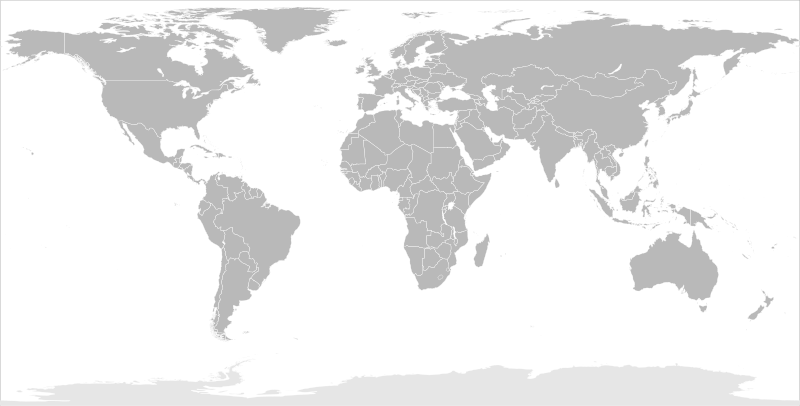
English: Blank political map of the world in modified (flattened) Robinson projection. This image is a sample of output from nugsl-worldmap, a Python script for the manipulation of this map. The script can also produce rotated images, add pinpoint marks at particular geographic coordinates, and produce web pages with clickable areas for specific countries and pinpoint marks.
Note that this map is not equirectangular, and cannot be used as a push-pin map to identify coordinates assuming equal latitude and longitude spacing. A map using the equirectangular projection is available at File:BlankMap-World6-Equirectangular.svg. |
| 日期 | (for the script only) |
| 來源 |
http://www.law.nagoya-u.ac.jp/en/appendix/software/worldmap/ Refactored from Image:BlankMap-World.svg, q.v. |
| 作者 | Frank Bennett |
| 授權許可 (重用此檔案) |
The map data manipulated by the script is in the public domain. The raw output of the script, including the file shown here, is also in the public domain. |
| 其他版本 |
Derivative works of this file:
|
| SVG開發 |
授權條款
[編輯]
| 我,此作品的版權所有人,釋出此作品至公共領域。此授權條款在全世界均適用。 這可能在某些國家不合法,如果是的話: 我授予任何人有權利使用此作品於任何用途,除受法律約束外,不受任何限制。 |
檔案歷史
點選日期/時間以檢視該時間的檔案版本。
| 日期/時間 | 縮圖 | 尺寸 | 用戶 | 備註 | |
|---|---|---|---|---|---|
| 目前 | 2014年3月20日 (四) 10:44 | | 2,754 × 1,397(1.68 MB) | Underlying lk(對話 | 貢獻) | fix classes for Soudan and South Soudan |
| 2013年3月16日 (六) 16:01 |  | 2,754 × 1,397(1.68 MB) | Flappiefh(對話 | 貢獻) | South Sudan added. | |
| 2008年1月14日 (一) 11:47 |  | 2,754 × 1,397(1.67 MB) | Biercenator(對話 | 貢獻) | Updated to current version of map produced by the script. | |
| 2007年12月19日 (三) 13:22 |  | 940 × 477(1.99 MB) | Biercenator(對話 | 貢獻) | == Summary == Refactored from en:Image:BlankMap-World6.svg, q.v. This image is a sample of output from [http://gsl-nagoya-u.net/appendix/software/worldmap/ nugsl-worldmap], a Python script for the manipulation and maintenance of this map. The flatt | |
| 2007年12月15日 (六) 15:31 |  | 940 × 477(2 MB) | Biercenator(對話 | 貢獻) | Refactored from en:Image:BlankMap-World6.svg, q.v. This image might prove useful if you want to change the area shown in the center of the Robinson projection version, since the conversion can be reversed. | |
| 2007年12月15日 (六) 15:18 |  | 940 × 477(2 MB) | Biercenator(對話 | 貢獻) | == Summary == Refactored from en:BlankMap-World6.svg, q.v. This image might prove useful if you want to area shown in the center of the Robinson projection version, since the conversion can be reversed. |
無法覆蓋此檔案。
檔案用途
超過 100 個頁面有用到此檔案。 下列清單只列出前 100 筆有用到此檔案的頁面。 您也可以檢視完整清單。
- User talk:Biercenator
- Commons:Graphic Lab/Map workshop/Archive/2014
- File:Algeria–United States Location.svg
- File:Angleterre bilan.svg
- File:Arabic Wikipedia – Most popular edition of Wikipedia by country – Wikimedia Traffic Analysis Report – 1 Jul 2009-31 Oct 2013.svg
- File:Argentina in the World (with Antarctica claims).svg
- File:Army2017-participants.svg
- File:Australia in the World.svg
- File:Australia in the World (+Antarctica claims).svg
- File:Azerbaijan in the World.svg
- File:Bangladesh–European Union Location.svg
- File:Bermuda–United States Location.svg
- File:BlankMap-FlatWorld6.svg (檔案重新導向)
- File:BlankMap-World.svg
- User talk:Biercenator
- File:China contour.svg
- File:Indian world contour.svg
- File:Globale Präsenz von Brose.png
- File:EAFF membres.svg
- File:SAFF membres.svg
- File:Angleterre bilan.svg
- File:Russia European part location map.png
- File:Egypt in the World.svg
- File:Argentina in the World (with Antarctica claims).svg
- File:Australia in the World (+Antarctica claims).svg
- File:Australia in the World.svg
- File:BlankMap-World.svg
- File:Brunei in the World.svg
- File:Chile in the World.svg
- File:Chile in the World (+Antarctica claims).svg
- File:China contour.svg
- File:Colombia in the World.svg
- File:Dimitri mitropoulos international music competition candidates by nation.svg
- File:EAFF membres.svg
- File:Egypt in the World.svg
- File:English Wikipedia – Most popular edition of Wikipedia by country – Wikimedia Traffic Analysis Report – 1 Jul 2009-31 Oct 2013.svg
- File:European Union in the World.svg
- File:European Union–Nepal Location.svg
- File:France in the World.svg
- File:France in the World (+Antarctica claims).svg
- File:France in the World (+Antarctica claims) (+EU).svg
- File:France in the World (+EU).svg
- File:French Wikipedia – Most popular edition of Wikipedia by country – Wikimedia Traffic Analysis Report – 1 Jul 2009-31 Oct 2013.svg
- File:Georgia in the World.svg
- File:Globale Präsenz von Brose.png
- File:Greece in the World.svg
- File:Greece in the World (+EU).svg
- File:Greenland in the World (+EU).svg
- File:Iceland in the World.svg
- File:Indian world contour.svg
- File:Indonesia in the World.svg
- File:Italy in the World.svg
- File:Italy in the World (+EU).svg
- File:Japan in the World.svg
- File:Kazakhstan in the World.svg
- File:Kingdom of Denmark in the World.svg
- File:Kingdom of Denmark in the World (+EU).svg
- File:Malaysia in the World.svg
- File:Malta in the World.svg
- File:Malta in the World (+EU).svg
- File:Mandatory bicycle helmet legislation.svg
- File:Map of Star Academy countries.svg
- File:Most popular edition of Wikipedia by country – Wikimedia Traffic Analysis Report – 1 Jul 2016-31 Jul 2016.svg
- File:Netherlands in the World.svg
- File:Netherlands in the World (+EU).svg
- File:New Zealand in the World.svg
- File:New Zealand in the World (+Antarctica claims).svg
- File:Norway in the World.svg
- File:Norway in the World (+Antarctica claims).svg
- File:Norway in the World (+Antarctica claims) cropped.svg
- File:Panama in the World.svg
- File:Papua New Guinea in the World.svg
- File:Philippines in the World.svg
- File:Portugal in the World.svg
- File:Portugal in the World (+EU).svg
- File:Portuguese Wikipedia – Most popular edition of Wikipedia by country – Wikimedia Traffic Analysis Report – 1 Jul 2009-31 Oct 2013.svg
- File:Prediction map of World War III.svg
- File:Quoll range.png
- File:Quoll range map.jpg
- File:Russia European part location map.png
- File:Russia in the World.svg
- File:Russian Wikipedia – Most popular edition of Wikipedia by country – Wikimedia Traffic Analysis Report – 1 Jul 2009-31 Oct 2013.svg
- File:SAFF membres.svg
- File:Singapore in the World.svg
- File:South Africa in the World.svg
- File:Spaceports on Earth.svg
- File:Spain in the World.svg
- File:Spain in the World (+EU).svg
- File:Spanish Wikipedia – Most popular edition of Wikipedia by country – Wikimedia Traffic Analysis Report – 1 Jul 2009-31 Oct 2013.svg
- File:Suisse bilan.svg
- File:Timor-Leste in the World.svg
- File:Trinidad and Tobago in the World.svg
- File:Turkey in the World.svg
- File:UTC hue4map X world flat6.svg
- File:United Kingdom (+overseas territories and crown dependencies) in the World.svg
- File:United Kingdom (+overseas territories and crown dependencies) in the World (+Antarctica claims).svg
- File:United Kingdom (+overseas territories and crown dependencies) in the World (+Antarctica claims) (+EU).svg
- File:United Kingdom (+overseas territories and crown dependencies) in the World (+EU).svg
- File:United States in the World.svg
- File:United States–Seychelles Location.svg
.svg)
.svg)
.svg)
.svg)
_(%2BEU).svg)
.svg)
.svg)
.svg)
.svg)
.svg)
.svg)
.svg)
.svg)
.svg)
_cropped.svg)
.svg)
.svg)
_in_the_World.svg)
_in_the_World_(%2BAntarctica_claims).svg)
_in_the_World_(%2BAntarctica_claims)_(%2BEU).svg)
_in_the_World_(%2BEU).svg)
檢視連結到這個檔案的更多連結。
全域檔案使用狀況
以下其他 wiki 使用了這個檔案:
- ca.wikipedia.org 的使用狀況
- de.wikipedia.org 的使用狀況
- en.wikipedia.org 的使用狀況
- es.wikipedia.org 的使用狀況
- fr.wikipedia.org 的使用狀況
- he.wikipedia.org 的使用狀況