File:BlankMap-World-v7.png
Original file (1,425 × 625 pixels, file size: 37 KB, MIME type: image/png)
Captions
Captions

|
File:BlankMap-World.svg is a vector version of this file. It should be used in place of this PNG file.
File:BlankMap-World-v7.png → File:BlankMap-World.svg
For more information, see Help:SVG. |
 |
Summary[edit]
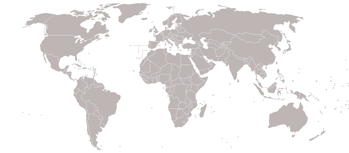
Blank political world map, based on Image:BlankMap-World-v5.png, but including all dependencies (i.e. all territories with ISO 3166-1 codes)
For sovereign countries which are depicted by a dot, the dot is five pixels wide. For dependencies, the dot is smaller - four pixels wide.
Special thanks to Astrokey44 for his map Image:BlankMap-World-v6.png, upon which a large part of this map is also based.
This image is outdated. The territories have been updated on Image:BlankMap-World-v8.png.
Old message: Please update this map. I've created a draft version here [1], but for whatever reason can't update this file. The draft reflects territorial changes (independence of South Sudan, annexation of Crimea, etc) and other minor edits (inclusion of Hawaii, inclusion of Antarctic claims, inclusion of lakes, etc).Image:BlankMap-World-v5.png
![[1]](https://en.wikipedia.org/wiki/File:World_Map-7.png)
Licensing[edit]

|
Permission is granted to copy, distribute and/or modify this document under the terms of the GNU Free Documentation License, Version 1.2 or any later version published by the Free Software Foundation; with no Invariant Sections, no Front-Cover Texts, and no Back-Cover Texts. A copy of the license is included in the section entitled GNU Free Documentation License. |
| This file is licensed under the Creative Commons Attribution-Share Alike 3.0 Unported license. | ||
| ||
| This licensing tag was added to this file as part of the GFDL licensing update. |
File history
Click on a date/time to view the file as it appeared at that time.
| Date/Time | Thumbnail | Dimensions | User | Comment | |
|---|---|---|---|---|---|
| current | 23:17, 7 March 2018 | | 1,425 × 625 (37 KB) | Maphobbyist (talk | contribs) | South Sudan border |
| 07:36, 16 January 2010 |  | 1,425 × 625 (27 KB) | Happenstance (talk | contribs) | fx | |
| 07:34, 16 January 2010 |  | 1,425 × 625 (27 KB) | Happenstance (talk | contribs) | darker colour for easier editing in Photoshop (so it doesn't default to grey-scale) | |
| 14:49, 31 July 2008 |  | 1,425 × 625 (48 KB) | Avala (talk | contribs) | ||
| 08:09, 7 July 2008 |  | 1,425 × 625 (48 KB) | Eynar (talk | contribs) | Updated according to Image:BlankMap-World-v7-Borders.png: Fixed connecting pixel between Argentina and Chile. Added Canary Islands, Madeira and Azores (Canary Islands have a total area of 7447 km2, so I put their shape instead of a dot). | |
| 21:59, 22 March 2008 |  | 1,425 × 625 (48 KB) | Nightstallion (talk | contribs) | Reverted to version as of 16:40, 13 March 2008 | |
| 19:33, 19 March 2008 |  | 1,425 × 625 (48 KB) | Patstuart (talk | contribs) | Reverted to version as of 18:25, 11 March 2008 - see Image talk:BlankMap-World-v6.png#As stated in reversion | |
| 16:40, 13 March 2008 |  | 1,425 × 625 (48 KB) | Nightstallion (talk | contribs) | no, there does not have to be; upload a variant if you wish, but please this image as it is (or start a discussion somewhere BEFORE reverting) | |
| 18:25, 11 March 2008 |  | 1,425 × 625 (48 KB) | Avala (talk | contribs) | there must be international consensus to show this as a final border. shading would be the best solution or stripes | |
| 20:16, 25 February 2008 |  | 1,425 × 625 (48 KB) | Nightstallion (talk | contribs) | Reverted to version as of :, 0 <> |
You cannot overwrite this file.
File usage on Commons
The following page uses this file: