File:Blank Map World Secondary Political Divisions.svg
跳转到导航
跳转到搜索

此SVG文件的PNG预览的大小:512 × 260像素。 其他分辨率:320 × 163像素 | 640 × 325像素 | 1,024 × 520像素 | 1,280 × 650像素 | 2,560 × 1,300像素。
原始文件 (SVG文件,尺寸为512 × 260像素,文件大小:2.38 MB)
说明
说明
添加一行文字以描述该文件所表现的内容
摘要
[编辑]
| 描述 |
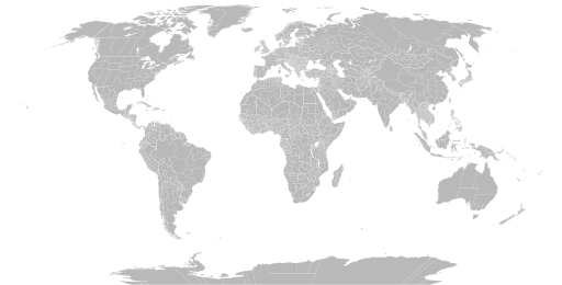
English: A detailed Robinson projection SVG map of the world with secondary political units grouped for easy coloring. |
| 日期 | |
| 来源 | |
| 作者 |
|
许可协议
[编辑]
我,本作品著作权人,特此采用以下许可协议发表本作品:
| 本作品采用知识共享CC0 1.0 通用公有领域贡献许可协议授权。 | |
| 采用本宣告发表本作品的人,已在法律允许的范围内,通过在全世界放弃其对本作品拥有的著作权法规定的所有权利(包括所有相关权利),将本作品贡献至公有领域。您可以复制、修改、传播和表演本作品,将其用于商业目的,无需要求授权。
|
文件历史
点击某个日期/时间查看对应时刻的文件。
| 日期/时间 | 缩略图 | 大小 | 用户 | 备注 | |
|---|---|---|---|---|---|
| 当前 | 2024年6月28日 (五) 03:22 | | 512 × 260(2.38 MB) | ClaveScottPH(留言 | 贡献) | Fixed Greenland, some overlapping subdivisions, and others. Added subdivisions for Fiji, Malta, São Tomé and Príncipe, and Trinidad & Tobago. |
| 2024年6月25日 (二) 08:02 |  | 512 × 260(9.25 MB) | ClaveScottPH(留言 | 贡献) | Fixed. | |
| 2024年6月22日 (六) 02:08 |  | 512 × 260(3.45 MB) | ClaveScottPH(留言 | 贡献) | Fixed colors for comoros, fixed overlapping for Abkhazia, and added subdivisions for Bahrain. | |
| 2024年6月20日 (四) 14:06 |  | 512 × 260(2.47 MB) | ClaveScottPH(留言 | 贡献) | Fixed division for the Central African Republic, Montenegro, and Thailand; fixed overlapping divisions for Morocco, Nigeria, Palestine, South Ossetia (disputed), and Taiwan (disputed). | |
| 2024年6月10日 (一) 06:50 |  | 512 × 260(2.42 MB) | ClaveScottPH(留言 | 贡献) | Fixed | |
| 2024年6月10日 (一) 04:01 |  | 3,413 × 1,752(5.9 MB) | ClaveScottPH(留言 | 贡献) | {{subst:update-note|1=File:Blank Map World Secondary Political Divisions.svg|2=new cantons in Luxembourg, municipalities in Latvia, new regions in Chile, Tanzania, the Philippines, Mali, Kazakhstan, Ghana, and Ethiopia, new prefectures in the Central African Republic, new provinces in Equatorial Guinea, Burundi, Algeria, Laos, Indonesia, Nepal, and the Democratic Republic of the Congo, new governorates in Lebanon and Oman, new administrative area in South Sudan have been created.}} ~~~~ | |
| 2022年5月28日 (六) 19:10 |  | 2,560 × 1,314(4.59 MB) | Betseg(留言 | 贡献) | Reverted to version as of 00:32, 13 March 2022 (UTC). Nearly double the size because of the high detailed divisions, and the colours were broken. | |
| 2022年5月7日 (六) 21:47 |  | 2,560 × 1,314(7.27 MB) | Abbasi786786(留言 | 贡献) | Made Pakistan and Nigeria more precise; Added new Congolese provinces | |
| 2022年3月13日 (日) 00:32 |  | 2,560 × 1,314(4.59 MB) | Abbasi786786(留言 | 贡献) | Merged KPK and former FATA, Pakistan | |
| 2021年12月13日 (一) 11:20 |  | 2,560 × 1,314(4.59 MB) | W0nderhat(留言 | 贡献) | Reverted to version as of 18:26, 6 June 2020 (UTC); removal of Chilean Patagonia unnecessary and confusing, ISO codes an unfortunate casualty (will look into how to restore them) |
您不可以覆盖此文件。
文件用途
以下41个页面使用本文件:
- Atlas of first-level administrative divisions
- User:Alex Great/Favorites
- User:Ninjatacoshell
- File:Americas Secondary Political Divisions map.svg
- File:Andrias davidianus map.svg
- File:BlankMap-World-Subdivisions.PNG
- File:BlankMap-World-Subdivisions1.png
- File:BlankMap-World.svg
- File:Blank Map with US subdivisions.svg
- File:Blank world map with US states borders.svg
- File:Boophis fayi map.svg
- File:Boophis popi map.svg
- File:Cape and African Honey Bee range.svg
- File:Mycena aurentiomarginata distribution.svg
- File:Symphyotrichum adnatum distribution.png
- File:Symphyotrichum bimater distribution.png
- File:Symphyotrichum bullatum distribution.png
- File:Symphyotrichum ciliatum native distribution.png
- File:Symphyotrichum concolor distribution.png
- File:Symphyotrichum dumosum distribution.png
- File:Symphyotrichum georgianum distribution.png
- File:Symphyotrichum leone distribution.png
- File:Symphyotrichum parviflorum distribution.svg
- File:Symphyotrichum phlogifolium distribution.png
- File:Symphyotrichum purpurascens distribution.png
- File:Symphyotrichum regnellii distribution.png
- File:Symphyotrichum subulatum distribution.png
- File:Symphyotrichum tenuifolium distribution.png
- File:Symphyotrichum trilineatum distribution.png
- File:Symphyotrichum vahlii distribution.png
- File:Symphyotrichum walteri distribution.png
- File:Symphyotrichum × versicolor distribution.png
- File:World98+.svg
- File:World98.svg
- File:World administrative levels.png
- File:Закордонні виборчі дільниці України.svg
- File:Результати Виборів Президента України 2019 у Закордонному виборчому окрузі (другий тур).svg
- File:Результати Виборів Президента України 2019 у Закордонному виборчому окрузі (перший тур).svg
- File:Результати Виборів народних депутатів України 2019 у Закордонному виборчому окрузі.svg
- File:Результати Парламентських виборів в Україні 2012 у Закордонному виборчому окрузі.svg
- File:Результати Парламентських виборів в Україні 2014 у Закордонному виборчому окрузі.svg
.svg)
.svg)
全域文件用途
以下其他wiki使用此文件:
- bn.wikipedia.org上的用途
- bs.wikipedia.org上的用途
- en.wikipedia.org上的用途
- Government
- Administrative division
- Wikipedia:Blank maps
- Wikipedia:Graphics Lab/Map workshop/Archive/May 2011
- User:Naqsh-e hJahan/List of provinces
- User talk:Naqsh-e hJahan/List of provinces
- Wikipedia:Graphics Lab/Illustration workshop/Archive/Jun 2023
- Wikipedia:Graphics Lab/Map workshop/Archive/Jul 2023
- ja.wikipedia.org上的用途
- ne.wikipedia.org上的用途
- sq.wikipedia.org上的用途
- sr.wikipedia.org上的用途
- te.wikipedia.org上的用途
- tr.wikipedia.org上的用途
- zh.wikipedia.org上的用途