File:Blank map of the world (Robinson projection) (10E).svg
Pumunta sa nabigasyon
Pumunta sa paghahanap

Size of this PNG preview of this SVG file: 800 x 413 na pixel. Ibang mga resolusyon: 320 x 165 na pixel | 640 x 330 na pixel | 1,024 x 529 na pixel | 1,280 x 661 na pixel | 2,560 x 1,321 na pixel | 3,100 x 1,600 na pixel.
Orihinal na file (SVG na file, nominal na 3,100 × 1,600 (na) pixel, laki: 1.33 MB)
Captions
Captions
Add a one-line explanation of what this file represents

|
This file has been superseded by BlankMap-World.svg. It is recommended to use the other file. Please note that deleting superseded images requires consent. Reason to use the other file: "Due to a lot of finer detail being regularly updated, it is recommended to use the original file. If a colored version is indeed needed, please take your time update this file from the latest version of the original – it is a fairly trivial exercise that can be done in a couple minutes using a text editor."
|
Buod
[baguhin]_(10E).svg&action=edit§ion=1)
| Paglalarawan |
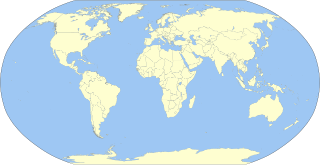
English: A detailed Robinson-projection SVG blank political map with grouping enabled to connect all non-contiguous parts of a country's territory for easy colouring. Smaller countries can also be represented by larger circles to show their data easier. A thorough description of use and other instructions relating to can be found on the instruction page. |
||
| Petsa | |||
| Pinanggalingan | Own work based on: BlankMap-World.svg by Canuckguy | ||
| May-akda | Milenioscuro | ||
| Iba pang mga bersyon | Derivative works of this file: Corrientes-oceanicas.svg | ||
| SVG genesis | Ang source code ng itong SVG ay hindi wasto dahil sa isang pagkamali.
|
Paglilisensiya
[baguhin]_(10E).svg&action=edit§ion=2)
Ako, na may karapatang-ari ng akdang ito, ang naglalathala nito alinsunod sa ilalim ng sumusunod na mga lisensya:
| Ako, ang may tangan ng karapatang-ari ng akdang ito, ay pinakakawalan ang akdang ito sa nasasakupan ng madla. Magagamit ito sa buong mundo. Maaaring hindi ito posibleng legal sa ilang mga bansa; kung ganito: Ibinibigay ko sa sinuman ang karapatang gamitin ang akdang ito para sa anumang layunin, na walang mga kundisyon, maliban na lang kung ang ganyang mga kundisyon ay kailangan ng batas. |
Tala ng orihinal na pagkarga
[baguhin]_(10E).svg&action=edit§ion=3)
This image is a derivative work of the following images:
- BlankMap-World.svg licensed with PD-self
Uploaded with derivativeFX
Nakaraan ng file
Pindutin ang isang petsa/oras para makita ang file noong puntong yon.
| Petsa/Oras | Thumbnail | Sukat | Tagagamit | Komento | |
|---|---|---|---|---|---|
| ngayon | 23:10, 2 Oktubre 2023 | | 3,100 × 1,600 (1.33 MB) | Milenioscuro (usapan | ambag) | Reverted to version as of 03:06, 7 March 2015 (UTC) |
| 08:47, 1 Oktubre 2023 |  | 3,100 × 1,600 (1.35 MB) | Caawiyahaderon (usapan | ambag) | https://www.thehindu.com/news/international/pro-somalia-militia-takes-key-army-base-in-breakaway-region/article67238670.ece | |
| 03:06, 7 Marso 2015 |  | 3,100 × 1,600 (1.33 MB) | Milenioscuro (usapan | ambag) | new color scheme | |
| 19:08, 29 Nobyembre 2014 |  | 3,100 × 1,600 (2 MB) | David1010 (usapan | ambag) | new | |
| 15:16, 9 Oktubre 2012 |  | 3,100 × 1,600 (1.99 MB) | Milenioscuro (usapan | ambag) | + Puerto Rico | |
| 04:18, 16 Mayo 2011 |  | 3,100 × 1,600 (1.99 MB) | Milenioscuro (usapan | ambag) | {{Information |Description={{en|1=A detailed Robinson-projection SVG map with grouping enabled to connect all non-contiguous parts of a country's territory for easy colouring. Smaller countries can also be represented by larger circles to sho |
Hindi mo mao-overwrite ang file na ito.
Paggamit sa file
Ginagamit ng sumusunod na pahina ang file na ito:
Pandaigdigang paggamit sa file
Ginagamit ng mga sumusunod na wiki ang file na ito:
- Paggamit sa ast.wikipedia.org
- Paggamit sa az.wikipedia.org
- Paggamit sa ba.wikipedia.org
- Paggamit sa be.wikipedia.org
- Paggamit sa bg.wikipedia.org
- Paggamit sa ca.wikipedia.org
- Paggamit sa cs.wikipedia.org
- Paggamit sa dag.wikipedia.org
- Paggamit sa da.wikipedia.org
- Paggamit sa en.wikipedia.org
- User:Acad Ronin
- User:Tcr25
- User:Bduke
- Wikipedia:Userboxes/Interests
- User:Arkiedragon
- User:Xgravity23
- User:Adamw1993
- User:Svaksha
- User:Goldsztajn
- User:Dcmacnut
- Wikipedia:Userboxes/Travel
- User:Paperworkorange
- User:Anas1712
- User:Alfie66
- Talk:Dependent territory/Archive 1
- User:Stefán Örvar Sigmundsson
- User:Arkenstrone
- User:The Emperor of Byzantium
- User:Arkiedragon/userboxes
- User:Muzilon
- User:Byrappa
- User:EdJF
- User:RubenSchade/Userboxes
- User:Duke of Geography
- User:Drdpw
- User:Rtucker913/userboxes
- User:Greatuser/userboxes
- User:Greatuser/Userboxes/countries visited
- User:Greatuser/Userboxes/countries visited/doc
- User:Guillermofdezg
- User:Liberty Pedia
- User:Gray Catbird
- Wikipedia:Userboxes/Interests/05
- User:Farmboybello
Tingnan ang karagdagang pandaigdigang paggamit sa file na ito.
_(10E).svg)
_(10E).svg&oldid=837274397)