File:Bologna - mappa quartieri pre-2016.svg
Jump to navigation
Jump to search

Size of this PNG preview of this SVG file: 504 × 471 pixels. Other resolutions: 257 × 240 pixels | 514 × 480 pixels | 822 × 768 pixels | 1,096 × 1,024 pixels | 2,192 × 2,048 pixels.
Original file (SVG file, nominally 504 × 471 pixels, file size: 17 KB)
Captions
Captions
Add a one-line explanation of what this file represents
Summary
[edit]
| Description |
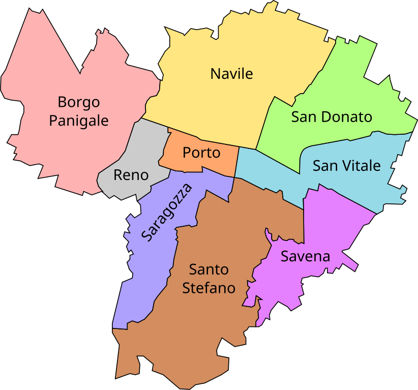
English: Map of boroughs of Bologna before 2016
Italiano: Mappa dei quartieri di Bologna fino al 2016. |
| Date | |
| Source | Own work |
| Author | Own work by uploader |
| Camera location | | View this and other nearby images on: OpenStreetMap |
|---|
Licensing
[edit]
| I, the copyright holder of this work, release this work into the public domain. This applies worldwide. In some countries this may not be legally possible; if so: I grant anyone the right to use this work for any purpose, without any conditions, unless such conditions are required by law. |
File history
Click on a date/time to view the file as it appeared at that time.
| Date/Time | Thumbnail | Dimensions | User | Comment | |
|---|---|---|---|---|---|
| current | 16:01, 23 February 2010 | | 504 × 471 (17 KB) | LucAndrea (talk | contribs) | Colors changed and optimized SVG. |
| 20:37, 2 May 2009 |  | 504 × 471 (23 KB) | Luca Andrea Rossi (talk | contribs) | Improved map | |
| 15:18, 5 April 2009 |  | 508 × 480 (21 KB) | Luca Andrea Rossi (talk | contribs) | {{Information |Description={{en|1=Map of Bologna}} {{it|1=Mappa dei quartieri di Bologna (Borgo Panigale, Navile, San Donato, San Vitale, Porto, Reno, Saragozza, Santo Stefano, Savena).}} |Source=Own work by uploader |Author=[[User:Luca Andrea Rossi|Luca |
You cannot overwrite this file.
File usage on Commons
The following page uses this file:
- File:Mappaquartieribologna.svg (file redirect)
File usage on other wikis
The following other wikis use this file:
- Usage on fr.wikipedia.org
- Usage on it.wikipedia.org