File:Borobudur Map zh-hans.svg
Jump to navigation
Jump to search

Size of this PNG preview of this SVG file: 800 × 444 pixels. Other resolutions: 320 × 178 pixels | 640 × 356 pixels | 1,024 × 569 pixels | 1,280 × 711 pixels | 2,560 × 1,422 pixels | 828 × 460 pixels.
Original file (SVG file, nominally 828 × 460 pixels, file size: 155 KB)
Captions
Captions
Add a one-line explanation of what this file represents
Summary[edit]
| Description |
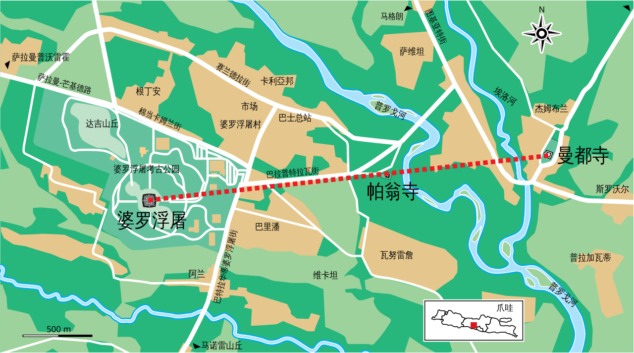
中文(简体):婆罗浮屠考古公园及其周边地图,显示曼都寺、帕翁寺和婆罗浮屠形成一条直线。由File:Borobudur_Map_en.svg改编。 |
| Date | |
| Source | Own work |
| Author | Alankang |
| Other versions |
[]
|


Licensing[edit]
I, the copyright holder of this work, hereby publish it under the following license:
This file is licensed under the Creative Commons Attribution-Share Alike 4.0 International license.
- You are free:
- to share – to copy, distribute and transmit the work
- to remix – to adapt the work
- Under the following conditions:
- attribution – You must give appropriate credit, provide a link to the license, and indicate if changes were made. You may do so in any reasonable manner, but not in any way that suggests the licensor endorses you or your use.
- share alike – If you remix, transform, or build upon the material, you must distribute your contributions under the same or compatible license as the original.
File history
Click on a date/time to view the file as it appeared at that time.
| Date/Time | Thumbnail | Dimensions | User | Comment | |
|---|---|---|---|---|---|
| current | 03:34, 27 January 2022 | | 828 × 460 (155 KB) | Alankang (talk | contribs) | Uploaded own work with UploadWizard |
You cannot overwrite this file.
File usage on Commons
The following 6 pages use this file: