File:Boswell Bay White Alice Communications System Site - Tropospheric Antennas.jpg
Jump to navigation
Jump to search

Size of this preview: 760 × 600 pixels. Other resolutions: 304 × 240 pixels | 608 × 480 pixels | 973 × 768 pixels | 1,280 × 1,010 pixels | 2,560 × 2,020 pixels | 4,853 × 3,830 pixels.
Original file (4,853 × 3,830 pixels, file size: 2.79 MB, MIME type: image/jpeg)
Captions
Captions
Add a one-line explanation of what this file represents
Summary
[edit]| Description |
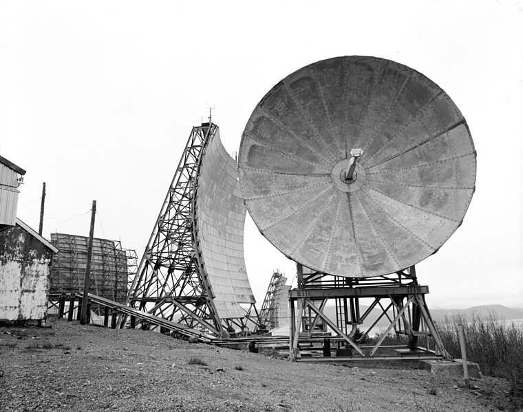
English: Boswell Bay White Alice Communications System Site, Tropospheric Antennas, Chugach National Forest, Cordova vicinity, Valdez-Cordova District, Alaska |
||
| Date | |||
| Source |
It is a part of the Historic American Engineering Record collection of photos.
|
||
| Author | Rob Stapleton |

| Camera location | | View this and other nearby images on: OpenStreetMap |
|---|
Licensing
[edit]

|
This file comes from the Historic American Buildings Survey (HABS), Historic American Engineering Record (HAER) or Historic American Landscapes Survey (HALS). These are programs of the National Park Service established for the purpose of documenting historic places. Records consist of measured drawings, archival photographs, and written reports.
|
| This image or media file contains material based on a work of a National Park Service employee, created as part of that person's official duties. As a work of the U.S. federal government, such work is in the public domain in the United States. See the NPS website and NPS copyright policy for more information. |
Original upload log
[edit]
The original description page was here. All following user names refer to en.wikipedia.
- 2006-02-08 02:50 Dual Freq 1024×810× (122103 bytes) Boswell Bay White Alice Site, Tropospheric Antennas, Chugach National Forest, Cordova vicinity, Valdez-Cordova District, AK This image was found at the Library of Congress HAER archive entry with the original caption: "FRONT OF ROUND ORANGE PEEL ANTENNA
File history
Click on a date/time to view the file as it appeared at that time.
| Date/Time | Thumbnail | Dimensions | User | Comment | |
|---|---|---|---|---|---|
| current | 01:33, 14 August 2011 | | 4,853 × 3,830 (2.79 MB) | Ras67 (talk | contribs) | high resolution |
| 12:55, 3 August 2011 |  | 968 × 766 (106 KB) | Ras67 (talk | contribs) | losslessly cropped with Jpegcrop | |
| 00:01, 4 January 2011 |  | 1,024 × 810 (119 KB) | File Upload Bot (Magnus Manske) (talk | contribs) | {{BotMoveToCommons|en.wikipedia|year={{subst:CURRENTYEAR}}|month={{subst:CURRENTMONTHNAME}}|day={{subst:CURRENTDAY}}}} {{Information |Description={{en|Boswell Bay en:White Alice Communications System Site, Tropospheric Antennas, [[:en:Chugach Natio |
You cannot overwrite this file.
File usage on Commons
The following page uses this file:
- File:000932pv.jpg (file redirect)
File usage on other wikis
The following other wikis use this file:
- Usage on az.wikipedia.org
- Usage on en.wikipedia.org
- Usage on fr.wikipedia.org
- Usage on ru.wikipedia.org