File:Boystown, Lakeview, Chicago, Illinois (43392099921).jpg

Original file (3,306 × 2,348 pixels, file size: 7.67 MB, MIME type: image/jpeg)
Captions
Captions
Summary
[edit].jpg&action=edit§ion=1)
| Description |
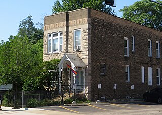
The Boystown section of Lakeview was the first officially recognized gay village in the United States. It is also the cultural center of one of the largest lesbian, gay, bisexual, and transgender (LGBT) communities in the nation. Boystown has grown into a cultural center for the LGBT residents living within the Chicago metropolitan area. The district's informal boundaries, overlapping with Lakeview East, are Irving Park Road on the north, Broadway on the east, Wellington Avenue on the south, and Sheffield Avenue on the west. The Center on Halsted, an LGBT community center, is also located in this area. Boystown is known for its colorful, lively nightlife and inviting atmosphere. Boystown also includes some of Chicago's off-Loop theater, specialty restaurants, greystone and brownstone walk-up buildings and other historic architecture, trendy fashion outlets, wine boutiques, chain stores, and independent shops. The city's annual Gays and Lesbians Chicago Pride Parade begins at the intersection of Montrose and Broadway, runs south along Broadway then Halsted to Belmont, turns east on Belmont to Broadway again, then south to Diversey, and then east to Sheridan Road. <a href="https://en.wikipedia.org/wiki/Lake_View,_Chicago#Boystown" rel="noreferrer nofollow">en.wikipedia.org/wiki/Lake_View,_Chicago#Boystown</a> <a href="https://en.wikipedia.org/wiki/Wikipedia:Text_of_Creative_Commons_Attribution-ShareAlike_3.0_Unported_License" rel="noreferrer nofollow">en.wikipedia.org/wiki/Wikipedia:Text_of_Creative_Commons_...</a> |
| Date | |
| Source | Boystown, Lakeview, Chicago, Illinois |
| Author | Ken Lund from Reno, Nevada, USA |
| Camera location | | View this and other nearby images on: OpenStreetMap |
|---|
.jpg¶ms=041.943452_N_-087.644803_E_globe:Earth_type:camera_source:Flickr_&language=en)
Licensing
[edit].jpg&action=edit§ion=2)
- You are free:
- to share – to copy, distribute and transmit the work
- to remix – to adapt the work
- Under the following conditions:
- attribution – You must give appropriate credit, provide a link to the license, and indicate if changes were made. You may do so in any reasonable manner, but not in any way that suggests the licensor endorses you or your use.
- share alike – If you remix, transform, or build upon the material, you must distribute your contributions under the same or compatible license as the original.
| This image was originally posted to Flickr by Ken Lund at https://flickr.com/photos/75683070@N00/43392099921. It was reviewed on 6 May 2024 by FlickreviewR 2 and was confirmed to be licensed under the terms of the cc-by-sa-2.0. |
File history
Click on a date/time to view the file as it appeared at that time.
| Date/Time | Thumbnail | Dimensions | User | Comment | |
|---|---|---|---|---|---|
| current | 07:30, 6 May 2024 | | 3,306 × 2,348 (7.67 MB) | SecretName101 (talk | contribs) | Transferred from Flickr via #flickr2commons |
You cannot overwrite this file.
File usage on Commons
There are no pages that use this file.
.jpg&oldid=874430122)