File:Brazil Distrito Federal Administrative Regions.png
(Redirected from File:Brazil Distrito Federal Municipalities.png)

Size of this preview: 800 × 540 pixels. Other resolutions: 320 × 216 pixels | 640 × 432 pixels | 1,024 × 691 pixels | 1,257 × 848 pixels.
Original file (1,257 × 848 pixels, file size: 22 KB, MIME type: image/png)
Captions
Captions
Add a one-line explanation of what this file represents
Summary
[edit]
| Description |
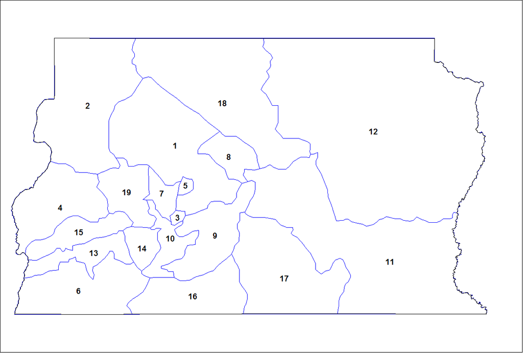
English: Map of the administrative regions of the Federal District of Brazil. Created by Rarelibra 21:34, 24 August 2006 (UTC) for public domain use. Created using MapInfo Professional v8.5 and various mapping resources. |
| Date | 24 August 2006 (original upload date) |
| Source |
Own work Transferred from en.wikipedia |
| Author | Rarelibra at en.wikipedia |
Licensing
[edit]
| |
This work has been released into the public domain by its author, Rarelibra, at the English Wikipedia project. This applies worldwide. In case this is not legally possible: |
Original upload log
[edit]
The original description page was here. All following user names refer to en.wikipedia.
- 2006-08-24 21:34 Rarelibra 1257×848 (22130 bytes) Map of the administrative regions of the Federal District of Brazil. Created by ~~~~ for public domain use. Created using MapInfo Professional v8.5 and various mapping resources.
File history
Click on a date/time to view the file as it appeared at that time.
| Date/Time | Thumbnail | Dimensions | User | Comment | |
|---|---|---|---|---|---|
| current | 15:06, 29 January 2012 | | 1,257 × 848 (22 KB) | BotMultichillT (talk | contribs) | {{BotMoveToCommons|en.wikipedia|year={{subst:CURRENTYEAR}}|month={{subst:CURRENTMONTHNAME}}|day={{subst:CURRENTDAY}}}} == {{int:filedesc}} == {{Information |description={{en|1=Map of the municipalities of the Federal District of Brazil. Created by [[:en: |
You cannot overwrite this file.
File usage on Commons
The following page uses this file:
- File:Brazil Distrito Federal Municipalities.png (file redirect)
File usage on other wikis
The following other wikis use this file:
- Usage on bpy.wikipedia.org
- Usage on en.wikipedia.org