File:Brazil Mato Grosso do Sul Grande Dourados location map.png
Jump to navigation
Jump to search
Size of this preview: 613 × 600 pixels. Other resolutions: 245 × 240 pixels | 491 × 480 pixels | 785 × 768 pixels | 1,047 × 1,024 pixels | 2,093 × 2,048 pixels.
Original file (2,093 × 2,048 pixels, file size: 505 KB, MIME type: image/png)
Captions
Captions
Add a one-line explanation of what this file represents
Summary
[edit]
| Description |
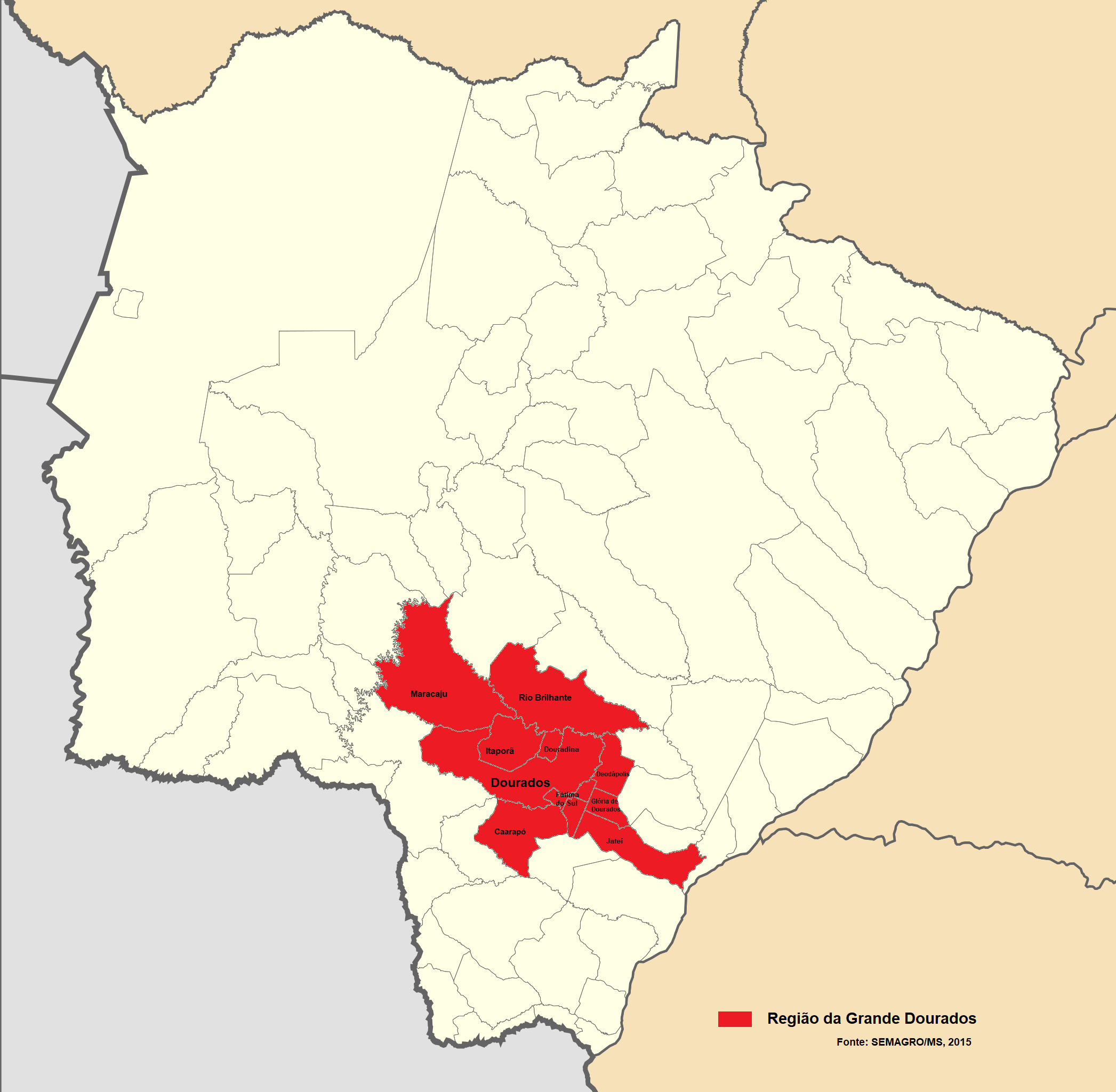
Português: Mapa da Região da Grande Dourados, conforme Estudo da Dimensão Territorial do Estado de Mato Grosso do Sul: Regiões de Planejamento elaborado pela Secretaria de Estado de Meio Ambiente e Desenvolvimento Econômico (SEMAGRO/MS) |
| Date | |
| Source | Own work |
| Author | Michel Zanoni Camargo |
Secretaria de Estado de Meio Ambiente e Desenvolvimento Econômico do Estado de Mato Grosso do Sul (Janeiro de 2015). «Estudo da Dimensão Territorial do Estado de Mato Grosso do Sul: Regiões de Planejamento.» (PDF). http://www.semagro.ms.gov.br/wp-content/uploads/2017/06/estudo_dimensao_territorial_2015.pdf. Consultado em 9 de setembro de 2021
Licensing
[edit]
I, the copyright holder of this work, hereby publish it under the following license:
This file is licensed under the Creative Commons Attribution-Share Alike 4.0 International license.
- You are free:
- to share – to copy, distribute and transmit the work
- to remix – to adapt the work
- Under the following conditions:
- attribution – You must give appropriate credit, provide a link to the license, and indicate if changes were made. You may do so in any reasonable manner, but not in any way that suggests the licensor endorses you or your use.
- share alike – If you remix, transform, or build upon the material, you must distribute your contributions under the same or compatible license as the original.
File history
Click on a date/time to view the file as it appeared at that time.
| Date/Time | Thumbnail | Dimensions | User | Comment | |
|---|---|---|---|---|---|
| current | 19:59, 10 September 2021 | | 2,093 × 2,048 (505 KB) | Michel Zanoni Camargo (talk | contribs) | Uploaded own work with UploadWizard |
You cannot overwrite this file.
File usage on Commons
There are no pages that use this file.
File usage on other wikis
The following other wikis use this file:
- Usage on en.wikipedia.org
- Usage on pt.wikipedia.org