File:Brazil Sul political map.PNG
Jump to navigation
Jump to search
No higher resolution available.
Brazil_Sul_political_map.PNG (529 × 555 pixels, file size: 25 KB, MIME type: image/png)
Captions
Captions
Add a one-line explanation of what this file represents
Summary[edit]
| Description |
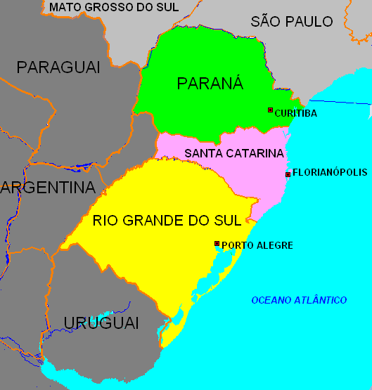
English: Political map of Southern Region of Brazil
Português: Mapa político da Região Sul do Brasil |
| Date | |
| Source | Own work |
| Author | Deyvid Setti |
| Permission (Reusing this file) |
This geographic map can be used for any educational, personal or commercial purposes. |
| Other versions | Image:Brazil_Region_States_Sul.svg |
Licensing[edit]
| I, the copyright holder of this work, release this work into the public domain. This applies worldwide. In some countries this may not be legally possible; if so: I grant anyone the right to use this work for any purpose, without any conditions, unless such conditions are required by law. |
File history
Click on a date/time to view the file as it appeared at that time.
| Date/Time | Thumbnail | Dimensions | User | Comment | |
|---|---|---|---|---|---|
| current | 23:50, 18 August 2008 | | 529 × 555 (25 KB) | Deyvid Setti~commonswiki (talk | contribs) | {{Information |Description={{en|1=Political map of Southern Region of Brazil}} {{pt|1=Mapa político da Região Sul do Brasil}} |Source=Trabalho próprio |Author=Deyvid Setti |Date=August 18, 2008 |Permission= |other_versions=[[:Imag |
You cannot overwrite this file.
File usage on Commons
There are no pages that use this file.
File usage on other wikis
The following other wikis use this file:
- Usage on ca.wikipedia.org
- Usage on eo.wikipedia.org
- Usage on ia.wikipedia.org
- Usage on pt.wikipedia.org
- Usage on www.wikidata.org