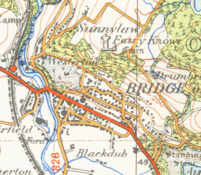
File:Bridge of Allanmap1945.png
来自Wikimedia Commons
跳转到导航
跳转到搜索

本预览的尺寸:687 × 600像素。 其他分辨率:275 × 240像素 | 550 × 480像素 | 913 × 797像素。
原始文件 (913 × 797像素,文件大小:1.65 MB,MIME类型:image/png)
文件信息
结构化数据
说明
说明
添加一行文字以描述该文件所表现的内容
| Public domainPublic domainfalsefalse |
这个由英国政府创作的作品属于公有领域。
其原因是以下之一:
HMSO已经宣布,皇家版权到期适用于全世界范围(参见HMSO的电子邮件回执) Deutsch ∙ English ∙ Español ∙ français ∙ italiano ∙ Nederlands ∙ polski ∙ português ∙ sicilianu ∙ slovenščina ∙ suomi ∙ Türkçe ∙ македонски ∙ русский ∙ українська ∙ മലയാളം ∙ 한국어 ∙ 日本語 ∙ 简体中文 ∙ 繁體中文 ∙ العربية ∙ +/− |
 |
| 描述Bridge of Allanmap1945.png | map of Bridge of Allan 1 inch to the mile scale scanned at 600 DPI |
| 日期 | |
| 来源 | OS map stirling and Dunfermline sheet 67 1945 |
| 作者 | OS |
文件历史
点击某个日期/时间查看对应时刻的文件。
| 日期/时间 | 缩略图 | 大小 | 用户 | 备注 | |
|---|---|---|---|---|---|
| 当前 | 2007年4月24日 (二) 01:51 |  | 913 × 797(1.65 MB) | Geni(留言 | 贡献) | {{oldOS}} {{Information |Description=map of Bridge of Allan 1 inch to the mile scale scanned at 600 DPI |Source=OS map stirling and Dunfermline sheet 67 1945 |Date=1945 |Author=OS |Permission=none needed |other_versions= }} Category:Maps of Stirling |
您不可以覆盖此文件。
文件用途
没有页面使用本文件。
全域文件用途
以下其他wiki使用此文件:
- en.wikipedia.org上的用途
- es.wikipedia.org上的用途
- zh.wikipedia.org上的用途