File:British Isles map showing UK, Republic of Ireland, and historic counties.svg
Vai alla navigazione
Vai alla ricerca

Dimensioni di questa anteprima PNG per questo file SVG: 408 × 599 pixel. Altre risoluzioni: 163 × 240 pixel | 327 × 480 pixel | 523 × 768 pixel | 697 × 1 024 pixel | 1 395 × 2 048 pixel | 1 250 × 1 835 pixel.
File originale (file in formato SVG, dimensioni nominali 1 250 × 1 835 pixel, dimensione del file: 1 003 KB)
Didascalie
Didascalie
Aggiungi una brevissima spiegazione di ciò che questo file rappresenta
Dettagli[modifica]
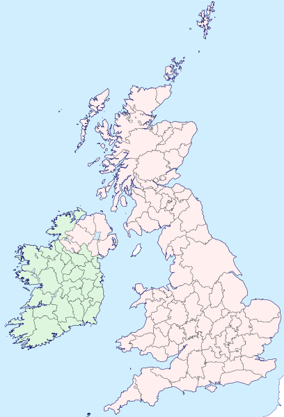
| Descrizione | Map of the British Isles with counties |
| Data | |
| Fonte | |
| Autore | Visitor from Wikishire |
| Licenza (Riusare questo file) |
Questo file è disponibile in base alla licenza Creative Commons Attribuzione-Condividi allo stesso modo 4.0 Internazionale Attribuzione: Wikishire
|
| SVG sviluppo | Il codice sorgente di questo file SVG non è valido a causa di 324 errori. Questa mappa in grafica vettoriale non valida secondo il W3C è stata creata con Inkscape…importante. |
Cronologia del file
Fare clic su un gruppo data/ora per vedere il file come si presentava nel momento indicato.
| Data/Ora | Miniatura | Dimensioni | Utente | Commento | |
|---|---|---|---|---|---|
| attuale | 19:35, 13 set 2019 | | 1 250 × 1 835 (1 003 KB) | Visitor from Wikishire (discussione | contributi) | Conformed colours to Hogweard's improvements |
| 22:32, 29 mag 2015 |  | 1 250 × 1 835 (1 002 KB) | Visitor from Wikishire (discussione | contributi) | Minor refinements & optional Yorkshire Ridings layer | |
| 21:53, 11 gen 2015 |  | 1 250 × 1 835 (933 KB) | Visitor from Wikishire (discussione | contributi) | {{Information |Description=Map of the British Isles with counties |Source=*[http://wikishire.co.uk/vectormap/GBDefinitionA.svg Wikishire: Vector map GB Definition A] *Ireland and Ulster, counties.svg |Date=201... | |
| 22:30, 17 nov 2014 |  | 1 250 × 1 830 (910 KB) | Visitor from Wikishire (discussione | contributi) | {{Information |Description=Map of the British Isles with counties |Source=*[http://wikishire.co.uk/vectormap/GBDefinitionA.svg] *Ireland and Ulster, counties.svg |Date=2014-11-17 |Author=[[:User:Visitor from W... |
Impossibile sovrascrivere questo file.
Utilizzo del file
Le seguenti 36 pagine usano questo file:
- File:Ayrshire.svg
- File:Banffshire County.svg
- File:Berwickshire County.svg
- File:British Isles in counties.svg (reindirizzamento file)
- File:Buteshire - Scotland.svg
- File:Cromartyshire - Scotland.svg
- File:Dumfriesshire County.svg
- File:Galloway.svg
- File:Inverness-shire - Scotland.svg
- File:Kincardineshire - Scotland.svg
- File:Kirkcudbrightshire - Scotland.svg
- File:Lanarkshire - Scotland.svg
- File:Lothian County.svg
- File:Map of Oswald distribution in Scotland 1690-1800.jpg
- File:Morayshire - Scotland.svg
- File:Perthshire County.svg
- File:Ross-shire County.svg
- File:Roxburghshire - Scotland.svg
- File:Selkirkshire - Scotland.svg
- File:Stirlingshire - Scotland.svg
- File:Tweeddale.svg
- File:Wales Historic Counties map.svg
- File:Wales Historic Counties map Anglesey.svg
- File:Wales Historic Counties map Brecknockshire.svg
- File:Wales Historic Counties map Caernarfonshire.svg
- File:Wales Historic Counties map Cardiganshire.svg
- File:Wales Historic Counties map Carmarthenshire.svg
- File:Wales Historic Counties map Denbighshire.svg
- File:Wales Historic Counties map Flintshire.svg
- File:Wales Historic Counties map Glamorgan.svg
- File:Wales Historic Counties map Merionethshire.svg
- File:Wales Historic Counties map Monmouthshire.svg
- File:Wales Historic Counties map Montgomeryshire.svg
- File:Wales Historic Counties map Pembrokeshire.svg
- File:Wales Historic Counties map Radnorshire.svg
- File:Wigtownshire - Scotland.svg
Utilizzo globale del file
Anche i seguenti wiki usano questo file:
- Usato nelle seguenti pagine di fr.wikipedia.org:
- Usato nelle seguenti pagine di ku.wikipedia.org:
- Cornwall
- Surrey
- Glamorgan
- Devon
- Somerset
- Dorset
- Yorkshire
- Lancashire
- County Cork
- Cumberland
- Northumberland
- Westmorland
- Kent
- Suffolk
- Norfolk
- Rutland
- Hampshire
- Wiltshire
- Berkshire
- Middlesex
- Hertfordshire
- Buckinghamshire
- Oxfordshire
- Gloucestershire
- Herefordshire
- Worcestershire
- Warwickshire
- Northamptonshire
- Bedfordshire
- Cambridgeshire
- Huntingdonshire
- Leicestershire
- Nottinghamshire
- Derbyshire
- Staffordshire
- Cheshire
- County Durham
- Lincolnshire
- Shropshire
- Şablon:Parêzgehên Giravên Brîtanî
- Angus
- Morayshire
- West Lothian
- East Lothian
- Midlothian
- Anglesey
- Brecknockshire
- Caernarfonshire
- Cardiganshire
Visualizza l'utilizzo globale di questo file.