File:Brownwood Farmhouse.jpg
Jump to navigation
Jump to search
Size of this preview: 728 × 600 pixels. Other resolutions: 291 × 240 pixels | 583 × 480 pixels | 933 × 768 pixels | 1,243 × 1,024 pixels | 2,487 × 2,048 pixels | 3,902 × 3,214 pixels.
Original file (3,902 × 3,214 pixels, file size: 1.78 MB, MIME type: image/jpeg)
Captions
Captions
Add a one-line explanation of what this file represents
|
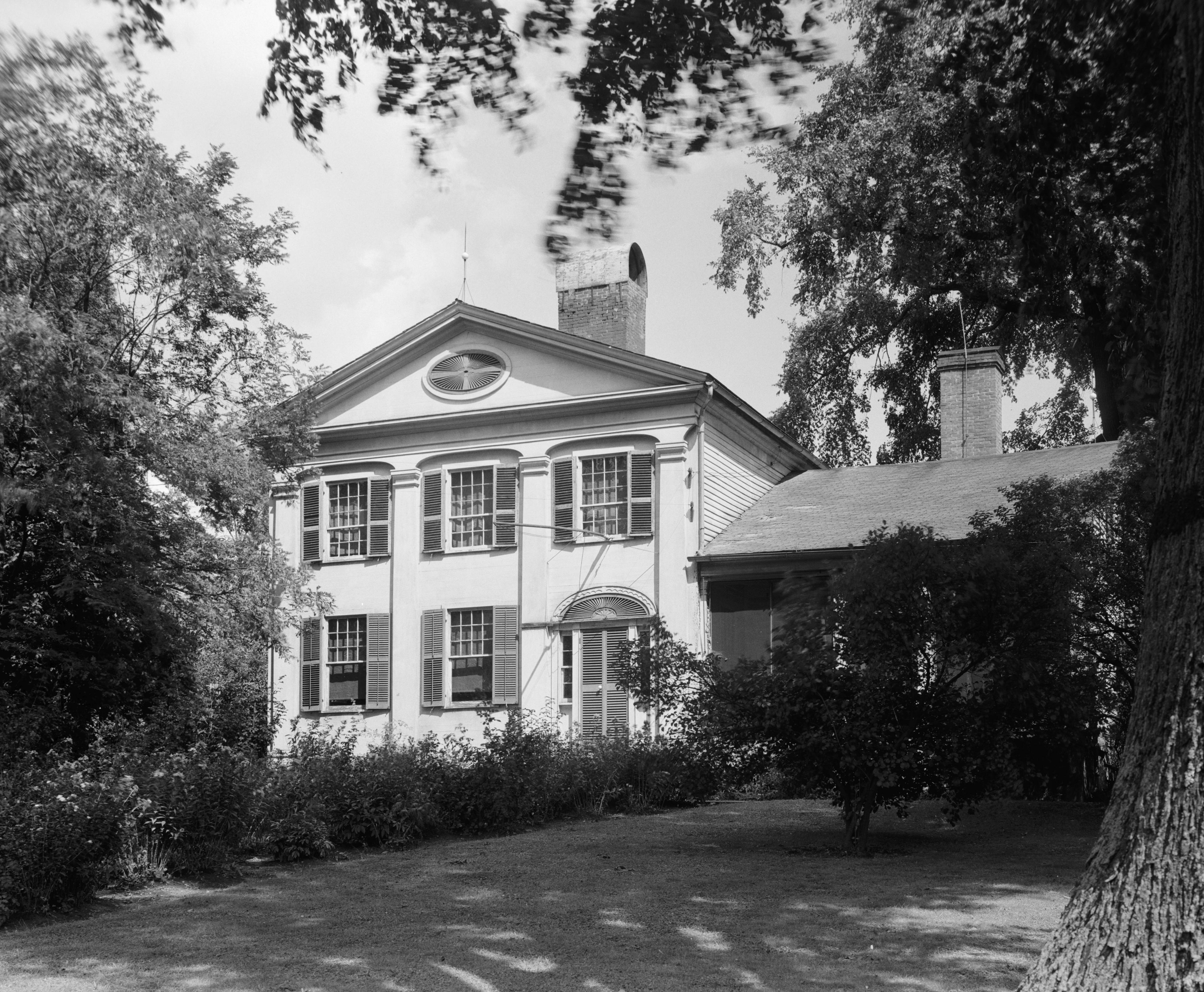
This is an image of a place or building that is listed on the National Register of Historic Places in the United States of America. Its reference number is 71000655. |
| Camera location | | View this and other nearby images on: OpenStreetMap |
|---|
| Description |
English: Front of the Brownwood Farmhouse, located off State Route 45 near North Bloomfield in Bloomfield Township, Trumbull County, Ohio, United States. Built in 1820, it is listed on the National Register of Historic Places. |
|||||
| Date | ||||||
| Source | Library of Congress, Prints and Photograph Division HABS: OHIO,78-BLOMN,1-1 | |||||
| Author | Carl Waite | |||||
| Permission (Reusing this file) |
|


|
This image is available from the United States Library of Congress's Prints and Photographs division
under the digital ID hhh.oh0198. This tag does not indicate the copyright status of the attached work. A normal copyright tag is still required. See Commons:Licensing.
|
File history
Click on a date/time to view the file as it appeared at that time.
| Date/Time | Thumbnail | Dimensions | User | Comment | |
|---|---|---|---|---|---|
| current | 01:52, 27 October 2010 | | 3,902 × 3,214 (1.78 MB) | Nyttend (talk | contribs) | {{Location|41|27|39|N|80|51|21|W}} {{Information |Description={{en|Front of the {{w|Brownwood (North Bloomfield, Ohio)|Brownwood Farmhouse}}, located off {{w|Ohio State Route 45|State Route 45}} near {{w|North Bloomfield, Ohio|North Bloomfield}} in {{w|Bl |
You cannot overwrite this file.
File usage on Commons
There are no pages that use this file.
File usage on other wikis
The following other wikis use this file:
- Usage on en.wikipedia.org