File:Bulgaria Shumen Province location map.svg
Jump to navigation
Jump to search

Size of this PNG preview of this SVG file: 500 × 599 pixels. Other resolutions: 200 × 240 pixels | 401 × 480 pixels | 641 × 768 pixels | 855 × 1,024 pixels | 1,709 × 2,048 pixels.
Original file (SVG file, nominally 500 × 599 pixels, file size: 262 KB)
Captions
Captions
Add a one-line explanation of what this file represents
Summary[edit]
| Description |
|
| Date | |
| Source |
Own work
|
| Author | Ikonact |
| Other versions |
|

Licensing[edit]
I, the copyright holder of this work, hereby publish it under the following licenses:

|
Permission is granted to copy, distribute and/or modify this document under the terms of the GNU Free Documentation License, Version 1.2 or any later version published by the Free Software Foundation; with no Invariant Sections, no Front-Cover Texts, and no Back-Cover Texts. A copy of the license is included in the section entitled GNU Free Documentation License. |
This file is licensed under the Creative Commons Attribution 3.0 Unported license.
- You are free:
- to share – to copy, distribute and transmit the work
- to remix – to adapt the work
- Under the following conditions:
- attribution – You must give appropriate credit, provide a link to the license, and indicate if changes were made. You may do so in any reasonable manner, but not in any way that suggests the licensor endorses you or your use.
You may select the license of your choice.
File history
Click on a date/time to view the file as it appeared at that time.
| Date/Time | Thumbnail | Dimensions | User | Comment | |
|---|---|---|---|---|---|
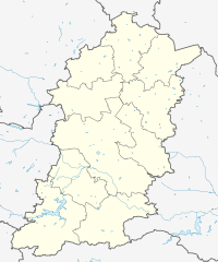
| current | 21:49, 4 June 2013 | | 500 × 599 (262 KB) | Ikonact (talk | contribs) | {{Information |description={{en|1=Location map Shumen Province, Bulgaria. Geographic limits of the map:}} {{bg|1=Позиционна карта на област Шумен, [[:b... |
You cannot overwrite this file.
File usage on Commons
The following page uses this file:
File usage on other wikis
The following other wikis use this file:
- Usage on bg.wikipedia.org
- Usage on ce.wikipedia.org
- Александрово (Шуменан область)
- Байково (Болгари)
- Беджене
- Белокопитово
- Благово (Шуменан область)
- Близнаци (Шуменан область)
- Божурово (Шуменан область)
- Борци
- Боян (эвла)
- Браничево (эвла)
- Буйновица
- Бяла-Река (Шуменан область)
- Бял-Бряг
- Васил-Друмев
- Векилски
- Велино (Болгари)
- Венец (Шуменан область)
- Веселиново (Шуменан область)
- Ветриште
- Вехтово
- Висока-Поляна (Шуменан область)
- Войвода
- Вылнари
- Вырбак
- Вырбяне
- Габрица (Шуменан область)
- Градиште (Шуменан область)
- Гусла
- Денница (Шуменан область)
- Дибич (эвла, Болгари)
- Длыжко
- Добри-Войниково
- Дойранци (Шуменан область)
- Долина (Шуменан область)
- Драгоево
- Дренци
- Друмево
- Единаковци (Болгари)
- Енево (Шуменан область)
- Желыд
- Живково (Шуменан область)
- Жилино (Болгари)
- Загориче (Болгари)
- Зайчино-Ореше
- Звегор
- Златар (Болгари)
- Златна-Нива
- Иваново (Шуменан область)
View more global usage of this file.