File:Bundesautobahn 4 map.png
跳至導覽
跳至搜尋

預覽大小:444 × 600 像素。 其他解析度:178 × 240 像素 | 355 × 480 像素 | 569 × 768 像素 | 1,122 × 1,515 像素。
原始檔案 (1,122 × 1,515 像素,檔案大小:80 KB,MIME 類型:image/png)
說明
說明
添加單行說明來描述出檔案所代表的內容
檔案歷史
點選日期/時間以檢視該時間的檔案版本。
| 日期/時間 | 縮圖 | 尺寸 | 使用者 | 備註 | |
|---|---|---|---|---|---|
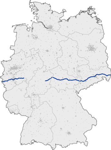
| 目前 | 2005年9月13日 (二) 09:07 | | 1,122 × 1,515(80 KB) | Qualle(留言 | 貢獻) | Bundesautobahn 4 in Germany 004 |
無法覆蓋此檔案。
檔案用途
下列2個頁面有用到此檔案:
全域檔案使用狀況
以下其他 wiki 使用了這個檔案:
- da.wikipedia.org 的使用狀況
- fi.wikipedia.org 的使用狀況
- fr.wikipedia.org 的使用狀況
- hr.wikipedia.org 的使用狀況
- hu.wikipedia.org 的使用狀況
- incubator.wikimedia.org 的使用狀況
- ja.wikipedia.org 的使用狀況
- no.wikipedia.org 的使用狀況
- pt.wikipedia.org 的使用狀況
- ru.wikipedia.org 的使用狀況
- sco.wikipedia.org 的使用狀況
- sk.wikipedia.org 的使用狀況
- sr.wikipedia.org 的使用狀況
- tr.wikipedia.org 的使用狀況
- zh.wikipedia.org 的使用狀況