Category:Maps of Bundesautobahn 4
Jump to navigation
Jump to search
Wikimedia category | |||||
| Upload media | |||||
| Instance of | |||||
|---|---|---|---|---|---|
| Category combines topics | |||||
| Bundesautobahn 4 | |||||
federal motorway in Germany | |||||
| Instance of | |||||
| Part of | |||||
| Location | |||||
| Transport network | |||||
| Connects with | |||||
| Owned by | |||||
| Maintained by | |||||
| Has part(s) | |||||
| Inception |
| ||||
| Length |
| ||||
| Terminus | |||||
| Different from | |||||
| |||||
Media in category "Maps of Bundesautobahn 4"
The following 32 files are in this category, out of 32 total.
-
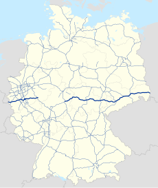
Bundesautobahn 4 (Ost).png 1,496 × 442; 86 KB
-
Bundesautobahn 4 (West).png 1,320 × 440; 93 KB
-
Bundesautobahn 4 map.png 1,122 × 1,515; 80 KB
-
Bundesautobahn 4.png 2,814 × 442; 186 KB
-
Map D A4.svg 1,073 × 1,272; 467 KB
-
Aachen.svg 300 × 250; 21 KB
-
AK-Aachen Ausbau2009.svg 571 × 394; 195 KB
-
AK-Aachen.png 1,200 × 900; 81 KB
-
Interchange Germany - Autobahnkreuz Aachen.svg 512 × 316; 150 KB
-
AK Chemnitz.svg 1,040 × 916; 515 KB
-
AD Dresden-Nord.svg 1,360 × 1,088; 2.35 MB
-
Map AD Dresden-Nord.svg 1,144 × 874; 533 KB
-
AD Dresden-West.svg 1,361 × 1,068; 1.76 MB
-
Map AD Dresden-West.svg 1,000 × 785; 532 KB
-
AK Erfurt.svg 1,255 × 930; 648 KB
-
Karte Erfurter Ring.svg 1,063 × 931; 2.27 MB
-
AK Hermsdofer Kreuz map.png 818 × 614; 408 KB
-
Hermsdorfer Kreuz der A4 mit der A9.png 1,476 × 1,104; 412 KB
-
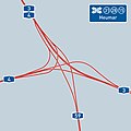
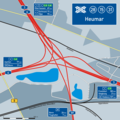
AD-Heumar.jpg 800 × 800; 55 KB
-
AK-Heumar.png 1,200 × 1,200; 182 KB
-
Kirchheimer Dreieck.jpg 391 × 391; 79 KB
-
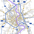
Autobahnring Köln.jpg 800 × 800; 38 KB
-
Koelner Ring.png 1,200 × 1,200; 150 KB
-
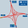
AK-Köln-Ost.jpg 800 × 800; 64 KB
-
AK-Köln-Ost.png 1,200 × 1,200; 114 KB
-
Kreuz Koeln Sued.jpg 369 × 372; 92 KB
-
AK-Köln-West Oktober 2017.svg 1,569 × 2,541; 3.09 MB
-
AK-Köln-West.png 1,000 × 1,500; 162 KB
-
Interchange Germany - Autobahnkreuz Köln-West.svg 1,300 × 2,000; 99 KB
-
AD Nossen.svg 1,049 × 943; 977 KB
-
AK Olpe-Süd.PNG 672 × 693; 250 KB
-
RAB Strecke 83 Variante Nossen.svg 746 × 655; 310 KB

