File:Business U.S. Route 41 (Marquette, MI) map.png
Jump to navigation
Jump to search
Size of this preview: 800 × 426 pixels. Other resolutions: 320 × 171 pixels | 640 × 341 pixels | 1,024 × 546 pixels | 1,694 × 903 pixels.
Original file (1,694 × 903 pixels, file size: 156 KB, MIME type: image/png)
Captions
Captions
Add a one-line explanation of what this file represents
Summary[edit]
_map.png&action=edit§ion=1)
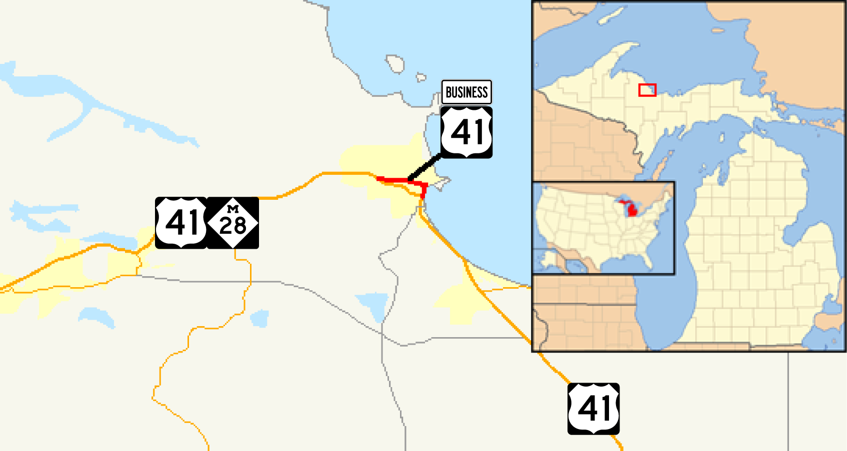
| Description | Map of w:U.S. Route 41 Business (Marquette, Michigan) |
| Date | |
| Source | Own work using public domain markers (File:Business plate.svg, File:US 41.svg and File:M-28.svg) and File:Michigan Locator Map with US.PNG. GIS data comes from Michigan Center for Geographic Information (May 2007). Geographic Data Library. Michigan Department of Information Technology. Archived from the original on 2011-07-17. Retrieved on August 5, 2012. |
| Author | Algorerhythms |
| Permission (Reusing this file) |
Overall file available under the GDL or CC-BY-SA licenses as below, incorporating public domain or CC-BY-SA3.0 elements |
Licensing[edit]
_map.png&action=edit§ion=2)
I, the copyright holder of this work, hereby publish it under the following licenses:

|
Permission is granted to copy, distribute and/or modify this document under the terms of the GNU Free Documentation License, Version 1.2 or any later version published by the Free Software Foundation; with no Invariant Sections, no Front-Cover Texts, and no Back-Cover Texts. A copy of the license is included in the section entitled GNU Free Documentation License. |
This file is licensed under the Creative Commons Attribution-Share Alike Attribution-Share Alike 4.0 International, 3.0 Unported, 2.5 Generic, 2.0 Generic and 1.0 Generic license.
- You are free:
- to share – to copy, distribute and transmit the work
- to remix – to adapt the work
- Under the following conditions:
- attribution – You must give appropriate credit, provide a link to the license, and indicate if changes were made. You may do so in any reasonable manner, but not in any way that suggests the licensor endorses you or your use.
- share alike – If you remix, transform, or build upon the material, you must distribute your contributions under the same or compatible license as the original.
You may select the license of your choice.
File history
Click on a date/time to view the file as it appeared at that time.
| Date/Time | Thumbnail | Dimensions | User | Comment | |
|---|---|---|---|---|---|
| current | 14:28, 29 April 2012 | | 1,694 × 903 (156 KB) | Imzadi1979 (talk | contribs) | Zoomed in and added inset |
| 02:38, 15 August 2008 |  | 1,014 × 650 (19 KB) | Algorerhythms (talk | contribs) | == Summary == {{Information |Description=Map of w:U.S. Route 41 Business (Marquette, Michigan) |Source=self-made |Date= |Author= Algorerhythms |Permission= |other_versions= }} US 41 BUS == Lice | |
| 02:33, 15 August 2008 |  | 1,014 × 650 (17 KB) | Algorerhythms (talk | contribs) | == Summary == {{Information |Description=Map of w:U.S. Route 41 Business (Marquette, Michigan) |Source=self-made |Date= |Author= Algorerhythms |Permission= |other_versions= }} US 41 BUS == Lice |
You cannot overwrite this file.
File usage on Commons
There are no pages that use this file.
_map.png&oldid=839779243)