File:CG Gosashi Kofun 2 7p.jpg
Jump to navigation
Jump to search

Size of this preview: 800 × 464 pixels. Other resolutions: 320 × 186 pixels | 640 × 371 pixels | 1,024 × 594 pixels | 1,280 × 742 pixels | 2,560 × 1,484 pixels.
Original file (2,560 × 1,484 pixels, file size: 2.66 MB, MIME type: image/jpeg)
Captions
Captions
Add a one-line explanation of what this file represents
Summary
[edit]
| Description |
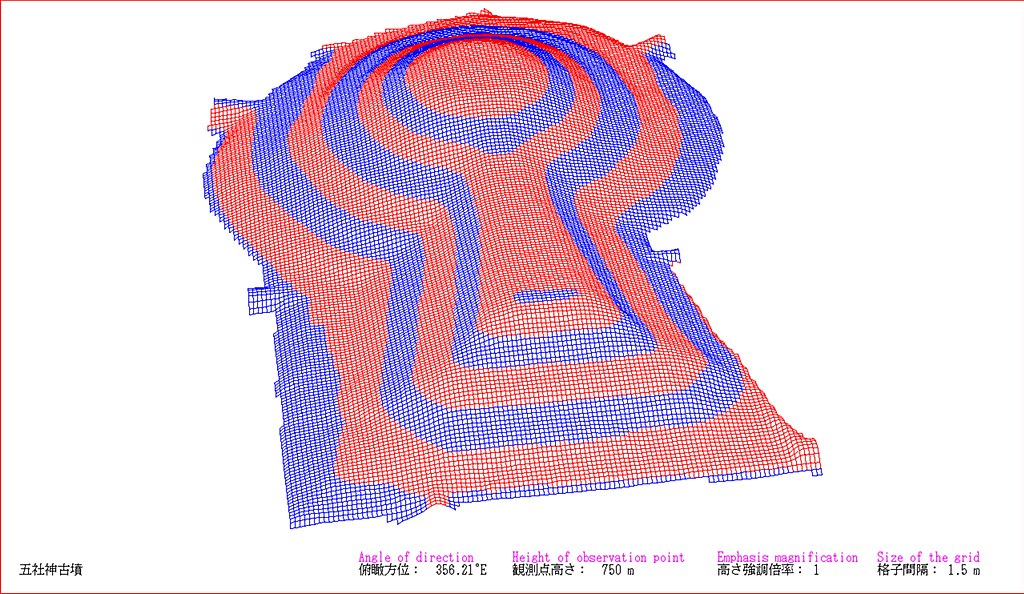
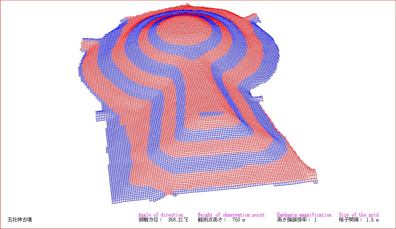
English: I who am a contributor drew the picture by a software which developed by myself.
The survey map which I referred to depends on "「神功皇后 狭城盾列池上陵墳塋裾護岸その他整備工事区域の調査および墳丘外形調査」(付図)『書陵部紀要』第56号 宮内庁書陵部 (2005年)". This is a drawing of present situation (not a drawing of a restored mound). The drawing depends on combination of wire frame and height eight phases classification. Perspective projection.日本語: 投稿者が自ら開発したソフトウェアで描画。
参照した測量図は、「神功皇后 狭城盾列池上陵墳塋裾護岸その他整備工事区域の調査および墳丘外形調査」(付図)『書陵部紀要』第56号 宮内庁書陵部 (2005年)による。 この図は現況図である(復元図ではない)。 描画は、ワイヤーフレームと高さ8段階色分けの併用による。透視投影。 |
| Date | |
| Source | Own work |
| Author | 名古屋太郎 |
| Camera location | | View this and other nearby images on: OpenStreetMap |
|---|
Licensing
[edit]
I, the copyright holder of this work, hereby publish it under the following licenses:
This file is licensed under the Creative Commons Attribution-Share Alike Attribution-Share Alike 4.0 International, 3.0 Unported, 2.5 Generic, 2.0 Generic and 1.0 Generic license.
- You are free:
- to share – to copy, distribute and transmit the work
- to remix – to adapt the work
- Under the following conditions:
- attribution – You must give appropriate credit, provide a link to the license, and indicate if changes were made. You may do so in any reasonable manner, but not in any way that suggests the licensor endorses you or your use.
- share alike – If you remix, transform, or build upon the material, you must distribute your contributions under the same or compatible license as the original.

|
Permission is granted to copy, distribute and/or modify this document under the terms of the GNU Free Documentation License, Version 1.2 or any later version published by the Free Software Foundation; with no Invariant Sections, no Front-Cover Texts, and no Back-Cover Texts. A copy of the license is included in the section entitled GNU Free Documentation License. |
You may select the license of your choice.
File history
Click on a date/time to view the file as it appeared at that time.
| Date/Time | Thumbnail | Dimensions | User | Comment | |
|---|---|---|---|---|---|
| current | 13:38, 1 December 2016 | | 2,560 × 1,484 (2.66 MB) | 名古屋太郎 (talk | contribs) | {{Information |Description ={{en|1=I who am a contributor drew the picture by a software which developed by myself. The survey map which I referred to depends on "「神功皇后 狭城盾列池上陵墳塋裾護岸その他整備工事区域の... |
You cannot overwrite this file.
File usage on Commons
There are no pages that use this file.
File usage on other wikis
The following other wikis use this file:
- Usage on ja.wikipedia.org