File:COVID-19 Outbreak Cases in France 13 Regions.svg
Jump to navigation
Jump to search

Size of this PNG preview of this SVG file: 720 × 600 pixels. Other resolutions: 288 × 240 pixels | 576 × 480 pixels | 922 × 768 pixels | 1,229 × 1,024 pixels | 2,458 × 2,048 pixels | 725 × 604 pixels.
Original file (SVG file, nominally 725 × 604 pixels, file size: 707 KB)
Captions
Captions
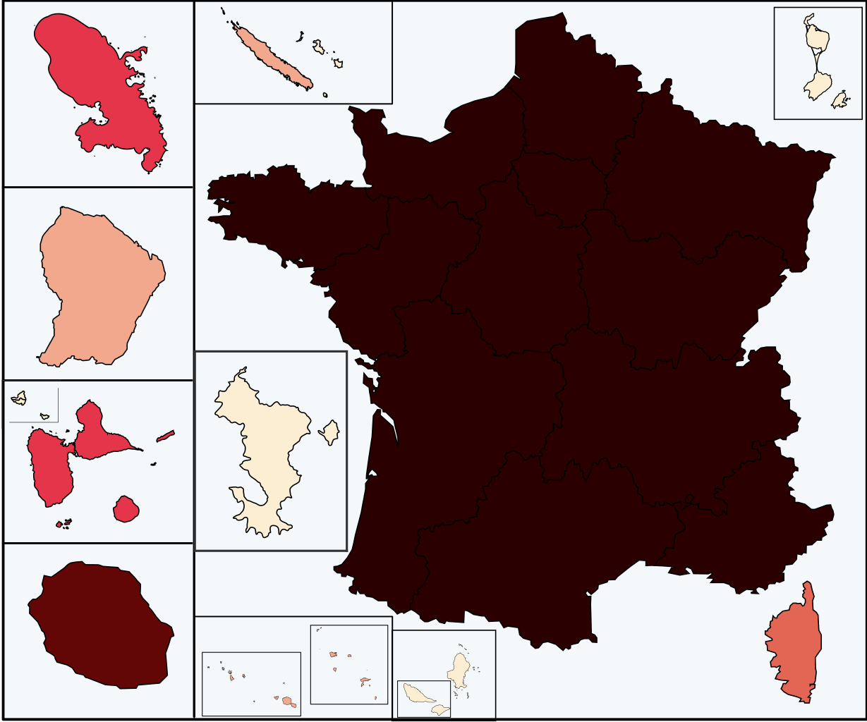
Map of the 2019-nCoV outbreak in France as of 3 Mars 2020. Be aware that since this is a rapidly evolving situation, new cases may not be immediately represented visually. Refer to the primary article [https://www.santepubliquefrance.fr SPF].
Summary[edit]
| Description |
Français : Les 13 régions métropolitaine de France + une région d'Outre-mer :
de 1 à 49 999 cas
de 50 000 à 99 999 cas
de 100 000 à 199 999 cas
de 200 000 à 299 999 cas
de 300 000 à 499 999 cas
de 500 000 à 699 999 cas
de 700 000 cas
|
| Date | 3 March 2020 Edit : 2020-03-04 |
| Source | Own work, data from santepubliquefrance and cnews |
| Author | Viruscorona2020 |
| SVG development | This W3C-invalid map was created with Adobe Illustrator, and with Inkscape. |
Licensing[edit]
I, the copyright holder of this work, hereby publish it under the following license:
This file is licensed under the Creative Commons Attribution-Share Alike 4.0 International license.
- You are free:
- to share – to copy, distribute and transmit the work
- to remix – to adapt the work
- Under the following conditions:
- attribution – You must give appropriate credit, provide a link to the license, and indicate if changes were made. You may do so in any reasonable manner, but not in any way that suggests the licensor endorses you or your use.
- share alike – If you remix, transform, or build upon the material, you must distribute your contributions under the same or compatible license as the original.
| Annotations | This image is annotated: View the annotations at Commons |
File history
Click on a date/time to view the file as it appeared at that time.
| Date/Time | Thumbnail | Dimensions | User | Comment | |
|---|---|---|---|---|---|
| current | 10:06, 13 November 2022 | | 725 × 604 (707 KB) | Sami270 (talk | contribs) | Update |
| 12:25, 12 May 2022 |  | 725 × 604 (707 KB) | Sami270 (talk | contribs) | Update 12 May 2022 | |
| 13:17, 1 January 2022 |  | 725 × 604 (736 KB) | Sami270 (talk | contribs) | Update 26 December 2021. Saint and Miquelon, Wallis and Futuna added. | |
| 08:03, 13 May 2021 |  | 725 × 604 (640 KB) | Sami270 (talk | contribs) | Update 9 May 2021 | |
| 09:05, 6 May 2021 |  | 725 × 604 (640 KB) | Sami270 (talk | contribs) | Update 2 May 2021 | |
| 07:42, 29 April 2021 |  | 725 × 604 (640 KB) | Sami270 (talk | contribs) | Fix Auvergne-Rhône-Alpes color | |
| 13:32, 22 April 2021 |  | 725 × 604 (640 KB) | Sami270 (talk | contribs) | Update 18 April 2021 | |
| 13:46, 15 April 2021 |  | 725 × 604 (640 KB) | Sami270 (talk | contribs) | Update 15 April 2021 | |
| 09:16, 11 April 2021 |  | 725 × 604 (640 KB) | Sami270 (talk | contribs) | Update 11 April 2021 | |
| 08:42, 1 April 2021 |  | 725 × 604 (640 KB) | Sami270 (talk | contribs) | Update 28 March 2021 |
You cannot overwrite this file.
File usage on Commons
There are no pages that use this file.
File usage on other wikis
The following other wikis use this file:
- Usage on az.wikipedia.org
- Usage on de.wikipedia.org
- Usage on es.wikipedia.org
- Usage on fi.wikipedia.org
- Usage on fr.wikipedia.org
- Usage on it.wikipedia.org