File:CP KCS Overview Map.jpg
Jump to navigation
Jump to search

Size of this preview: 800 × 518 pixels. Other resolutions: 320 × 207 pixels | 640 × 414 pixels | 1,024 × 663 pixels | 1,280 × 828 pixels | 2,000 × 1,294 pixels.
Original file (2,000 × 1,294 pixels, file size: 181 KB, MIME type: image/jpeg)
Captions
Captions
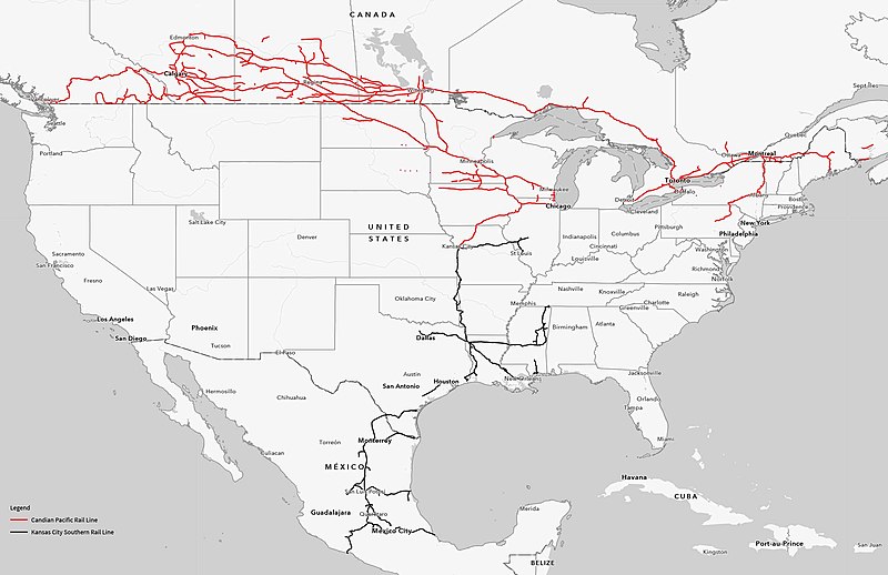
Map showing the combined Canadian Pacific and Kansas City Southern railways
Summary[edit]
| Description |
English: Map showing the combined Canadian Pacific Railway (depicted in red) and Kansas City Southern (in black) Railway. |
| Date | 01-27-2023 |
| Source |
"Canadian Pacific Acquisition of Kansas City Southern; Final Environmental Impact Statement." Docket No. FD36500. https://www.cp-kcsmergereis.com/img/CP-KCS-Overview-Map.jpg |
| Author | U.S. Surface Transportation Board, Washington, D.C. |
Licensing[edit]
This work is in the public domain in the United States because it is a work prepared by an officer or employee of the United States Government as part of that person’s official duties under the terms of Title 17, Chapter 1, Section 105 of the US Code.
Note: This only applies to original works of the Federal Government and not to the work of any individual U.S. state, territory, commonwealth, county, municipality, or any other subdivision. This template also does not apply to postage stamp designs published by the United States Postal Service since 1978. (See § 313.6(C)(1) of Compendium of U.S. Copyright Office Practices). It also does not apply to certain US coins; see The US Mint Terms of Use.
|
 | |
| This file has been identified as being free of known restrictions under copyright law, including all related and neighboring rights. | ||
File history
Click on a date/time to view the file as it appeared at that time.
| Date/Time | Thumbnail | Dimensions | User | Comment | |
|---|---|---|---|---|---|
| current | 02:02, 28 January 2023 | | 2,000 × 1,294 (181 KB) | RickyCourtney (talk | contribs) | Uploaded a work by Surface Transportation Board from https://www.cp-kcsmergereis.com/img/CP-KCS-Overview-Map.jpg with UploadWizard |
You cannot overwrite this file.
File usage on Commons
The following 3 pages use this file:
File usage on other wikis
The following other wikis use this file:
- Usage on ar.wikipedia.org
- Usage on de.wikipedia.org
- Usage on en.wikipedia.org
- Usage on es.wikipedia.org
- Usage on fi.wikipedia.org
- Usage on fr.wikipedia.org
- Usage on hu.wikipedia.org
- Usage on www.wikidata.org