File:Cabrerets La Pescalerie2.JPG
Jump to navigation
Jump to search

Size of this preview: 450 × 600 pixels. Other resolutions: 180 × 240 pixels | 360 × 480 pixels | 576 × 768 pixels | 768 × 1,024 pixels | 1,920 × 2,560 pixels.
Original file (1,920 × 2,560 pixels, file size: 1.9 MB, MIME type: image/jpeg)
Captions
Captions
Add a one-line explanation of what this file represents
Summary
[edit]
| Description |
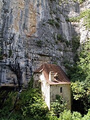
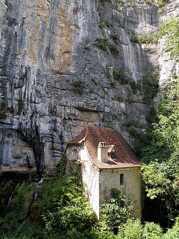
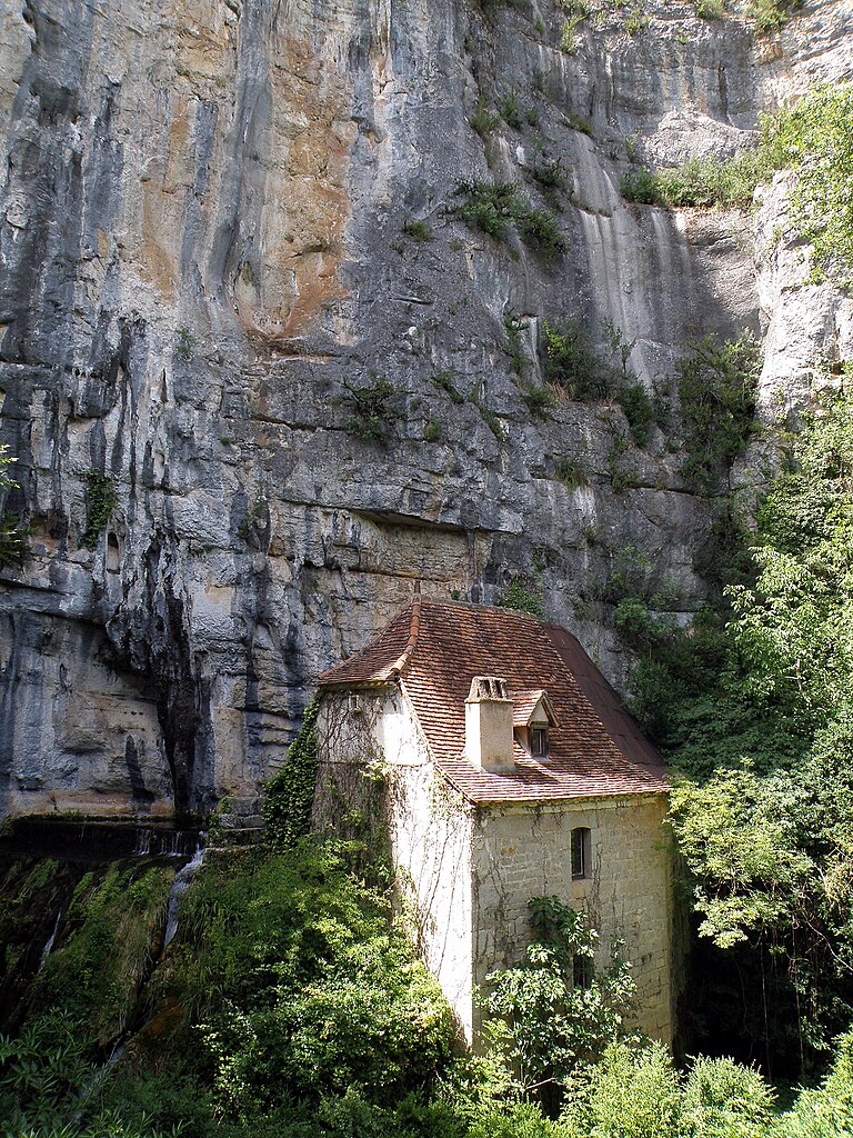
Français : Cabrerets, commune et village dans le département du Lot (région Midi-Pyrénées, France), situés sur le Célé, affluent droit du Lot, à une vingtaine de km (à vol d’oiseau) à l’est-nord-est de Cahors. Hameau de la Pescalerie, situé à env. 2 km au nord-est du village, en amont sur la rive droite du Célé. Moulin à eau construit à l'endroit d'une source vauclusienne. |
| Date | |
| Source | Self-photographed |
| Author | Torsade de Pointes |
Licensing
[edit]
| I, the copyright holder of this work, release this work into the public domain. This applies worldwide. In some countries this may not be legally possible; if so: I grant anyone the right to use this work for any purpose, without any conditions, unless such conditions are required by law. |
File history
Click on a date/time to view the file as it appeared at that time.
| Date/Time | Thumbnail | Dimensions | User | Comment | |
|---|---|---|---|---|---|
| current | 20:40, 16 October 2010 | | 1,920 × 2,560 (1.9 MB) | Torsade de Pointes (talk | contribs) | {{Information |Description={{fr|1=Cabrerets (Lot) }} |Source=Photographie personnelle |Author=Torsade de Pointes |Date= |Permission= |other_versions= }} |
You cannot overwrite this file.
File usage on Commons
There are no pages that use this file.
File usage on other wikis
The following other wikis use this file:
- Usage on fr.wikipedia.org