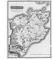
File:Caithness Shire 1822 parish map.jpg

Original file (6,656 × 8,192 pixels, file size: 14.53 MB, MIME type: image/jpeg)
Captions
Captions
Summary[edit]
| DescriptionCaithness Shire 1822 parish map.jpg |
English: Caithness Shire (northeast corner of mainland Scotland) map with civil parish subdivision |
| Date | |
| Source | https://stataccscot.edina.ac.uk/static/statacc/dist/county/Caithness |
| Author | Peter Manson (Landsurveyor), William Campbell Keiss (drawn), T. Clerk (engraved) |
Licensing[edit]
| Public domainPublic domainfalsefalse |
|
This work is in the public domain in its country of origin and other countries and areas where the copyright term is the author's life plus 70 years or fewer. This work is in the public domain in the United States because it was published (or registered with the U.S. Copyright Office) before January 1, 1929. | |
| This file has been identified as being free of known restrictions under copyright law, including all related and neighboring rights. | |
https://creativecommons.org/publicdomain/mark/1.0/PDMCreative Commons Public Domain Mark 1.0falsefalse
File history
Click on a date/time to view the file as it appeared at that time.
| Date/Time | Thumbnail | Dimensions | User | Comment | |
|---|---|---|---|---|---|
| current | 12:33, 28 October 2019 |  | 6,656 × 8,192 (14.53 MB) | Pemu (talk | contribs) | Harvested again with [https://commonsarchive.wmflabs.org/wiki/File:Create_Stitch_Script_V2.ods Create Stitch Script V2.ods] from https://stataccscot.edina.ac.uk/data/thomson-county-maps/tiles/74400135/5/3/0.jpg … https://stataccscot.edina.ac.uk/data/thomson-county-maps/tiles/74400135/5/28/31.jpg The three leftmost tiles (only plain white) has been left out. |
| 12:29, 28 October 2019 |  | 256 × 256 (20 KB) | Pemu (talk | contribs) | Tile from the somewhere in the middle | |
| 12:28, 28 October 2019 |  | 256 × 256 (478 bytes) | Pemu (talk | contribs) | Tile from top-left (0,0). Seems to be bw? | |
| 19:40, 27 October 2019 |  | 7,424 × 8,192 (13.65 MB) | Pemu (talk | contribs) | Harvested with [https://commonsarchive.wmflabs.org/wiki/File:Create_Stitch_Script_V2.ods Create Stitch Script V2.ods] from https://stataccscot.edina.ac.uk/data/thomson-county-maps/tiles/74400135/5/0/0.jpg … https://stataccscot.edina.ac.uk/data/thomson-county-maps/tiles/74400135/5/28/31.jpg | |
| 18:38, 27 October 2019 |  | 778 × 1,000 (312 KB) | Ratzer (talk | contribs) | User created page with UploadWizard |
You cannot overwrite this file.
File usage on Commons
There are no pages that use this file.
File usage on other wikis
The following other wikis use this file:
- Usage on de.wikipedia.org
Metadata
This file contains additional information such as Exif metadata which may have been added by the digital camera, scanner, or software program used to create or digitize it. If the file has been modified from its original state, some details such as the timestamp may not fully reflect those of the original file. The timestamp is only as accurate as the clock in the camera, and it may be completely wrong.
| JPEG file comment | Created Wed Oct 7 17:39:17 2015 by ./thomson-tiles4.1.pl |
|---|