File:California Interstate 80.svg
跳至導覽
跳至搜尋

此 SVG 檔案的 PNG 預覽的大小:800 × 444 像素。 其他解析度:320 × 178 像素 | 640 × 356 像素 | 1,024 × 569 像素 | 1,280 × 711 像素 | 2,560 × 1,422 像素 | 1,152 × 640 像素。
原始檔案 (SVG 檔案,表面大小:1,152 × 640 像素,檔案大小:631 KB)
說明
說明
添加單行說明來描述出檔案所代表的內容
摘要
[編輯]
| 描述 |
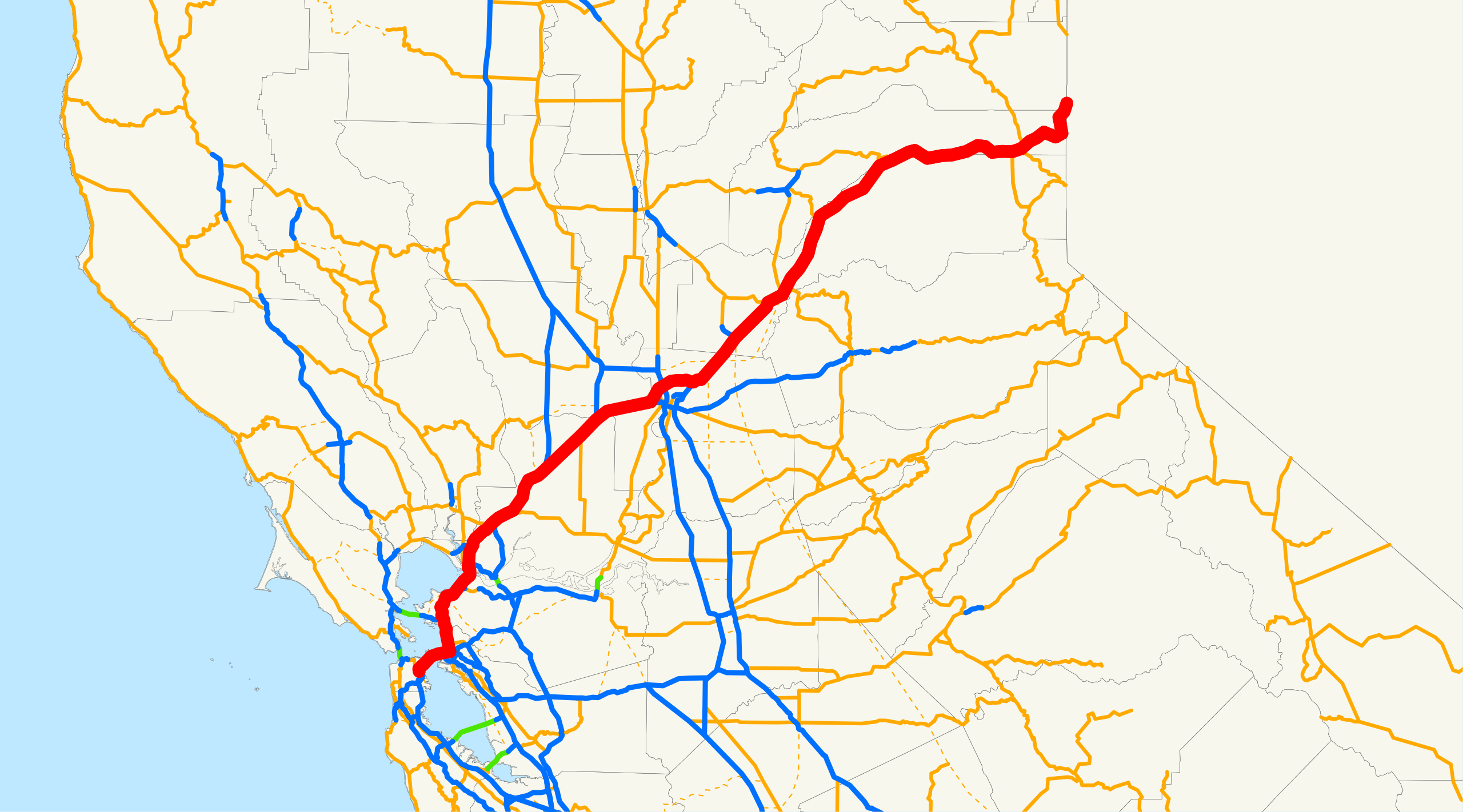
English: Map of Interstate 80 in California. The Interstate runs from the Bay Bridge in San Francisco, east through Sacramento and over the Sierra Nevada, to the Nevada border en route to Reno, Nevada. |
||
| 來源 | Email me if you would like a copy of the GIS data I created for the highways. | ||
| 作者 | NE2 (留言 · 貢獻) | ||
| 授權許可 (重用此檔案) |
|
Sources: BTS North American Transportation Atlas Data archive copy at the Wayback Machine, Caltrans State Truck Route List (XLS file), Caltrans Log of Bridges on State Highways, All Caltrans Traffic Volumes on CSHS, California State Legislature Definitions of Routes
檔案歷史
點選日期/時間以檢視該時間的檔案版本。
| 日期/時間 | 縮圖 | 尺寸 | 使用者 | 備註 | |
|---|---|---|---|---|---|
| 目前 | 2007年12月18日 (二) 18:25 | | 1,152 × 640(631 KB) | NE2(留言 | 貢獻) | == Summary == This is a map of Interstate 80 in California. Email me if you would like a copy of the GIS data I created for the highways. Category:Interstate 80 in California [[Category:Maps of state highways in California|0 |
無法覆蓋此檔案。
檔案用途
下列頁面有用到此檔案:
全域檔案使用狀況
以下其他 wiki 使用了這個檔案:
- da.wikipedia.org 的使用狀況
- es.wikipedia.org 的使用狀況
- ru.wikipedia.org 的使用狀況
- www.wikidata.org 的使用狀況
- zh.wikipedia.org 的使用狀況
分類:
- Interstate 80 in California
- Road maps of state highways in California
- Maps of San Francisco
- Maps of Alameda County, California
- Maps of Contra Costa County, California
- Maps of Solano County, California
- Maps of Napa County, California
- Maps of Yolo County, California
- Maps of Sacramento County, California
- Maps of Placer County, California
- Maps of Nevada County, California
- 2007 maps of California