File:California US Congressional District 39 (since 2013).tif
跳转到导航
跳转到搜索
此TIF文件的PNG预览的大小:800 × 390像素。 其他分辨率:320 × 156像素 | 640 × 312像素 | 1,024 × 499像素 | 2,016 × 982像素。
原始文件 (2,016 × 982像素,文件大小:3.09 MB,MIME类型:image/tiff)
说明
说明
添加一行文字以描述该文件所表现的内容
摘要
[编辑]| 描述 |
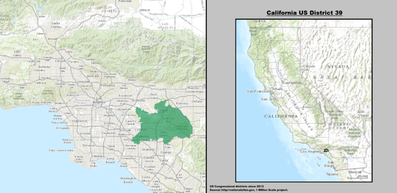
English: Boundaries for California's 39th US Federal Congressional District — Southern California.
|
| 日期 | |
| 来源 | GIS shapefile data created by the United States Department of the Interior, as part of the "1 Million Scale" geospatial data project. Retrieved from: http://nationalatlas.gov/atlasftp-1m.html?openChapters=#chpbound |
| 作者 | 1: GIS (congressional districts, 2013) shapefile data was created by the United States Department of the Interior. 2: Data was rendered using ArcGIS® software by Esri. 3: File developed for use on Wikipedia and elsewhere by 7partparadigm. |
许可协议
[编辑]本地图取自美国国家地图集的某个版本。正如几乎所有美国联邦政府作品一样,来自国家地图集的作品在美国属于公有领域。
在线访问:NationalAtlas.gov | 1970年印刷版:国会图书馆、Perry-Castañeda图书馆
|
文件历史
点击某个日期/时间查看对应时刻的文件。
| 日期/时间 | 缩略图 | 大小 | 用户 | 备注 | |
|---|---|---|---|---|---|
| 当前 | 2014年3月22日 (六) 03:36 | 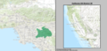 | 2,016 × 982(3.09 MB) | 7partparadigm(留言 | 贡献) | User created page with UploadWizard |
您不可以覆盖此文件。
文件用途
全域文件用途
以下其他wiki使用此文件:
- en.wikipedia.org上的用途
- fr.wikipedia.org上的用途
- hu.wikipedia.org上的用途
- tr.wikipedia.org上的用途
- www.wikidata.org上的用途
- zh.wikipedia.org上的用途