File:California map showing Mono County.png
Jump to navigation
Jump to search
No higher resolution available.
California_map_showing_Mono_County.png (200 × 231 pixels, file size: 22 KB, MIME type: image/png)
Captions
Captions
Add a one-line explanation of what this file represents
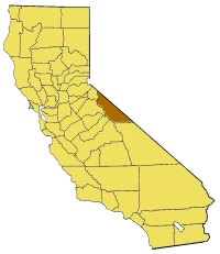
Map of Mono county in California. From en:

|
Permission is granted to copy, distribute and/or modify this document under the terms of the GNU Free Documentation License, Version 1.2 or any later version published by the Free Software Foundation; with no Invariant Sections, no Front-Cover Texts, and no Back-Cover Texts. A copy of the license is included in the section entitled GNU Free Documentation License. |
| This file is licensed under the Creative Commons Attribution-Share Alike 3.0 Unported license. | ||
| ||
| This licensing tag was added to this file as part of the GFDL licensing update. |
File history
Click on a date/time to view the file as it appeared at that time.
| Date/Time | Thumbnail | Dimensions | User | Comment | |
|---|---|---|---|---|---|
| current | 13:40, 13 July 2005 | | 200 × 231 (22 KB) | Pyramide~commonswiki (talk | contribs) | Map of Mono county in California. From en: {{GFDL}} Category:Maps of counties in California |
You cannot overwrite this file.
File usage on Commons
There are no pages that use this file.
File usage on other wikis
The following other wikis use this file:
- Usage on bg.wikipedia.org
- Usage on en.wikipedia.org
- Little Walker River
- Owens River Gorge
- Red Slate Mountain
- Mount Morgan (Mono County, California)
- Montgomery Peak
- Mount Morrison (California)
- Virginia Lakes
- Mount Davis (California)
- Masonic, California
- Morgan Creek (California)
- Template:MonoCountyCA-geo-stub
- Deadman Summit
- Dana Glacier (California)
- Conness Glacier
- Sonora Peak
- Lundy, California
- Glass Mountain (California)
- Leavitt Peak
- Sweetwater Mountains
- Bodie Hills
- Adobe Hills
- Brawley Peaks
- New Range
- Belfort, California
- Benton Hot Springs
- Hammil Valley, California
- Mill City, Mono County, California
- Mono Mills, California
- Montgomery City, California
- Toms Place, California
- Monoville, California
- Wheeler Crest, California
- Wheeler Crest
- Oasis, Mono County, California
- Mono Mills Junction, California
- Rock Creek (Owens River tributary)
- Twin Lakes (Mammoth Lakes, California)
- Donohue Pass
- Coso County, California
- Dunderberg Peak
- Bloody Mountain (California)
- Koip Peak
- Kuna Peak
- Middle Sister (California)
- Agnew Lake (California)
- Alger Lakes
- Alger Creek
- Alpine Lake (Mono County, California)
- Blacktop Peak
View more global usage of this file.