File:Campo Imperatore Plateau - Pietracamela, Teramo, Italy - August 13, 2019 01.jpg
Jump to navigation
Jump to search

Size of this preview: 800 × 302 pixels. Other resolutions: 320 × 121 pixels | 640 × 242 pixels | 1,024 × 386 pixels | 1,280 × 483 pixels | 2,560 × 966 pixels | 13,966 × 5,271 pixels.
Original file (13,966 × 5,271 pixels, file size: 56.87 MB, MIME type: image/jpeg)
Captions
Captions
Add a one-line explanation of what this file represents
Summary
[edit]
| Description |
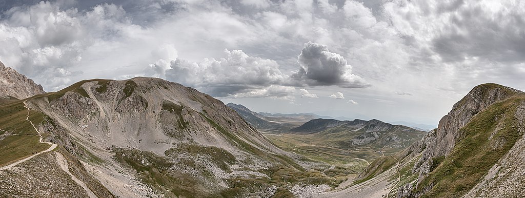
English: Altopiano di Campo Imperatore con Monte Aquila sulla sinistra - Pietracamela, Teramo, Italia |
| Date | |
| Source | Own work |
| Author | Giorgio Galeotti |
| Camera location | | View this and other nearby images on: OpenStreetMap |
|---|
Licensing
[edit]
I, the copyright holder of this work, hereby publish it under the following license:
This file is licensed under the Creative Commons Attribution 4.0 International license.
- You are free:
- to share – to copy, distribute and transmit the work
- to remix – to adapt the work
- Under the following conditions:
- attribution – You must give appropriate credit, provide a link to the license, and indicate if changes were made. You may do so in any reasonable manner, but not in any way that suggests the licensor endorses you or your use.
File history
Click on a date/time to view the file as it appeared at that time.
| Date/Time | Thumbnail | Dimensions | User | Comment | |
|---|---|---|---|---|---|
| current | 11:10, 31 August 2019 | 13,966 × 5,271 (56.87 MB) | GiorgioGaleotti (talk | contribs) | User created page with UploadWizard |
You cannot overwrite this file.
File usage on Commons
There are no pages that use this file.
File usage on other wikis
The following other wikis use this file:
- Usage on de.wikipedia.org
- Usage on it.wikipedia.org