File:Canada Alberta location map 2.svg
跳转到导航
跳转到搜索

此SVG文件的PNG预览的大小:486 × 599像素。 其他分辨率:195 × 240像素 | 389 × 480像素 | 623 × 768像素 | 831 × 1,024像素 | 1,662 × 2,048像素 | 1,512 × 1,863像素。
原始文件 (SVG文件,尺寸为1,512 × 1,863像素,文件大小:736 KB)
说明
说明
添加一行文字以描述该文件所表现的内容
| 描述 |
Deutsch: Positionskarte von Alberta, Kanada
Quadratische Plattkarte, N-S-Streckung 170 %. Geographische Begrenzung der Karte:
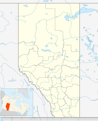
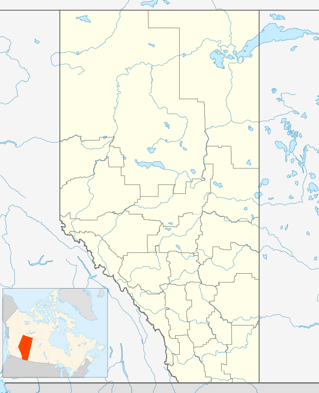
English: Location map of Alberta, Canada, showing the 19 census divisions.
Equirectangular projection, N/S stretching 170%. Geographic limits of the map:
Español: Divisiones censales de Alberta
Français : Les divisions de recensement de l'Alberta
Italiano: Divisioni censuarie dell'Alberta |
| 日期 | |
| 来源 | 自己的作品, File:Canada Alberta location map.svg by NordNordWest |
| 作者 | Hanhil (talk) 05:35, 24 September 2009 (UTC) |
| 授权 (二次使用本文件) |
我,本作品著作权人,特此采用以下许可协议发表本作品: 本文件采用知识共享署名-相同方式共享 3.0 未本地化版本许可协议授权。
|
文件历史
点击某个日期/时间查看对应时刻的文件。
| 日期/时间 | 缩略图 | 大小 | 用户 | 备注 | |
|---|---|---|---|---|---|
| 当前 | 2009年9月24日 (四) 05:35 | | 1,512 × 1,863(736 KB) | Hanhil(留言 | 贡献) | {{Information |Description= {{de|Positionskarte von Alberta, Kanada}} Quadratische Plattkarte, N-S-Streckung 170 %. Geographische Begrenzung der Karte: * N: 60.3° N * S: 48.7° N * W: 123.0° W * O: 107.0° W {{en|Location |
您不可以覆盖此文件。
文件用途
没有页面使用本文件。
全域文件用途
以下其他wiki使用此文件:
- af.wikipedia.org上的用途
- ar.wikipedia.org上的用途
- ast.wikipedia.org上的用途
- azb.wikipedia.org上的用途
- ba.wikipedia.org上的用途
- bg.wikipedia.org上的用途
- bs.wikipedia.org上的用途
- ceb.wikipedia.org上的用途
- ch.wikipedia.org上的用途
- ckb.wikipedia.org上的用途
- cs.wikipedia.org上的用途
- en.wikipedia.org上的用途
- eo.wikipedia.org上的用途
查看本文件的更多全域用途。