File:Canada Newfoundland relief location map - Long Range.jpg
Jump to navigation
Jump to search
Size of this preview: 524 × 599 pixels. Other resolutions: 210 × 240 pixels | 420 × 480 pixels | 824 × 942 pixels.
Original file (824 × 942 pixels, file size: 244 KB, MIME type: image/jpeg)
Captions
Captions
Add a one-line explanation of what this file represents
Summary[edit]
| Description |
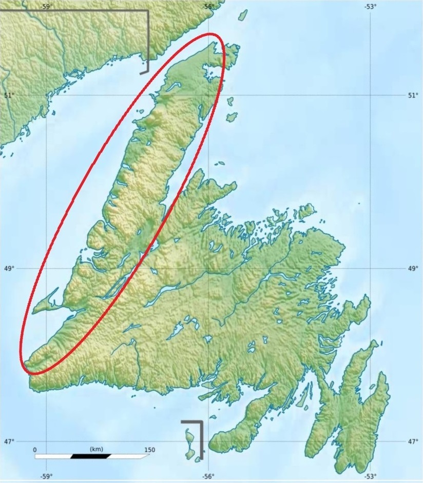
Français : Carte physique de Terre-Neuve, Canada. L'ovale au contour rouge cerne les monts Long Range. Projection équirectangulaire. Image étirée N/S de 160%. Coordonnées des bords de carte :
|
| Date | |
| Source | Canada Newfoundland and Labrador relief location map.jpg |
| Author | NordNordWest (vector version), Carport (topography), Flappiefh (cropping, scale and graticules). |
| Other versions |
Canada Newfoundland relief location map.jpg:  |
Licensing[edit]
This file is licensed under the Creative Commons Attribution-Share Alike 3.0 Unported license.
- You are free:
- to share – to copy, distribute and transmit the work
- to remix – to adapt the work
- Under the following conditions:
- attribution – You must give appropriate credit, provide a link to the license, and indicate if changes were made. You may do so in any reasonable manner, but not in any way that suggests the licensor endorses you or your use.
- share alike – If you remix, transform, or build upon the material, you must distribute your contributions under the same or compatible license as the original.
File history
Click on a date/time to view the file as it appeared at that time.
| Date/Time | Thumbnail | Dimensions | User | Comment | |
|---|---|---|---|---|---|
| current | 17:59, 22 December 2020 | | 824 × 942 (244 KB) | Jeangagnon (talk | contribs) | allongement de l'ovale au sud-ouest pour intégrer les monts Anguille |
| 17:16, 22 December 2020 |  | 824 × 942 (239 KB) | Jeangagnon (talk | contribs) | {{Information |description={{fr|1=Carte physique de Terre-Neuve, Canada.}}<br> Projection équirectangulaire. Image étirée N/S de 160%. Coordonnées des bords de carte : <br> *Top : 52.1 *Bottom : 46.52 *Left : -59.85 *Right : -52.03 <br> |date=2015-11-08 |source=Canada Newfoundland and Labrador relief location map.jpg |author=NordNordWest (vector version), Carport (top... |
You cannot overwrite this file.
File usage on Commons
There are no pages that use this file.
File usage on other wikis
The following other wikis use this file:
- Usage on fr.wikipedia.org