File:Candeleda 625.jpg
Jump to navigation
Jump to search

Size of this preview: 800 × 526 pixels. Other resolutions: 320 × 211 pixels | 640 × 421 pixels | 1,024 × 674 pixels | 1,280 × 842 pixels | 2,560 × 1,684 pixels | 3,206 × 2,109 pixels.
Original file (3,206 × 2,109 pixels, file size: 3.46 MB, MIME type: image/jpeg)
Captions
Captions
Add a one-line explanation of what this file represents
Summary
[edit]
| Description |
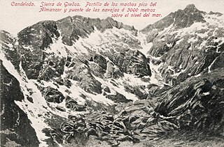
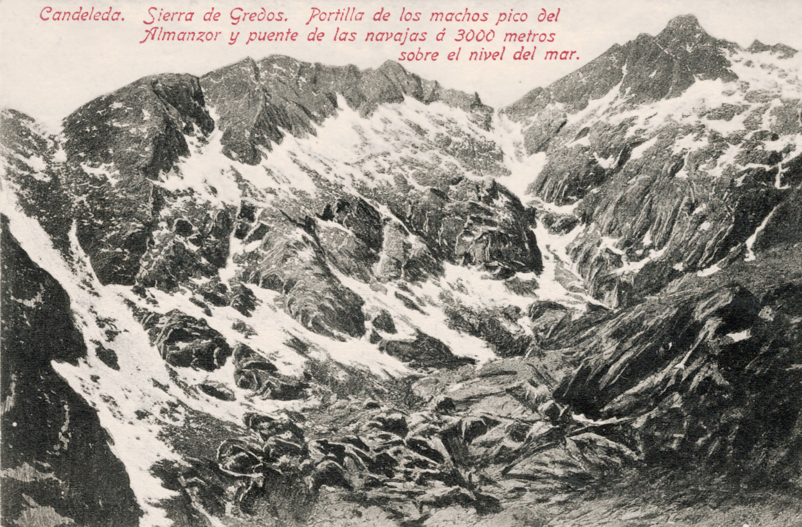
Español: Postal de la Sierra de Gredos. Candeleda (Ávila, Castilla y León, España)
El editor afirma que las cumbres están a 3.000 metros de altitud, lo cual no es cierto. La cumbre del Pico Almanzor (la más alta de todo el Sistema Central) se encuentra a 2.591 m.s.n.m. El error del editor local (Pérez Hermanos) tiene cierta justificación porque la hoja 577 del Mapa Topográfico Nacional E = 1:50.000, no se publicó hasta 1950. Había otros medios para conocer este dato, pero no accesibles al gran público |
| Date | 1920s |
| Source | CFolección propia |
| Author | Unknown author |
Licensing
[edit]
This image is in the public domain in Spain where the copyright term for anonymous or pseudonymous works is 80 years from the year of first publication or less.
Please give also an explanation why the work is in the public domain in the United States. If this work was published after 1929 and it was not in the public domain in Spain on the URAA date (January 1, 1996), use {{Not-PD-US-URAA}} in addition to this template.
For files in the public domain in the European Union, please use {{PD-anon-70-EU}}.
|
 |
File history
Click on a date/time to view the file as it appeared at that time.
| Date/Time | Thumbnail | Dimensions | User | Comment | |
|---|---|---|---|---|---|
| current | 09:15, 9 November 2023 | | 3,206 × 2,109 (3.46 MB) | LBM1948 (talk | contribs) | Uploaded a work by Desconocido from CFolección propia with UploadWizard |
You cannot overwrite this file.
File usage on Commons
The following page uses this file: