File:Capital Region International Airport USGS 08-Mar-2010.png
Spring til navigation
Spring til søgning
Ingen højere opløsning fundet.
Capital_Region_International_Airport_USGS_08-Mar-2010.png (536 × 326 billedpunkter, filstørrelse: 320 KB, MIME-type: image/png)
Captions
Captions
Tilføj en kort forklaring på en enkelt linje om hvad filen viser
Beskrivelse[redigér]
| Beskrivelse |
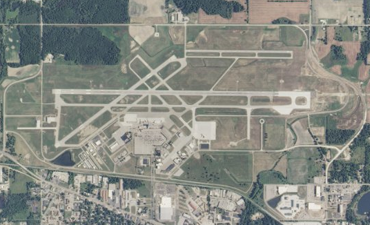
English: USGS orthophoto of Capital Region International Airport in Lansing, Michigan, United States - April 2007. Scale 1:36,112 |
| Dato | |
| Kilde |
USGS The National Map |
| Forfatter | United States Geological Survey (USGS) |
| Tilladelse (Genbrug af denne fil) |
Public domain |
Licensering[redigér]
This image is in the public domain in the United States because it only contains materials that originally came from the United States Geological Survey, an agency of the United States Department of the Interior. For more information, see the official USGS copyright policy.
|
Filhistorik
Klik på en dato/tid for at se filen som den så ud på det tidspunkt.
| Dato/tid | Miniaturebillede | Dimensioner | Bruger | Kommentar | |
|---|---|---|---|---|---|
| nuværende | 7. jul. 2010, 03:40 | | 536 × 326 (320 KB) | Dj1997 (diskussion | bidrag) | {{Information |Description={{en|1=Capital Region International Airport, Lansing, Michigan, USGS aerial photo - 08 Mar 2010. Scale 1:36,112}} |Source=http://viewer.nationalmap.gov/view |
Du kan ikke overskrive denne fil.
Filanvendelse
Den følgende side bruger denne fil:
Global filanvendelse
Følgende andre wikier anvender denne fil:
- Anvendelser på arz.wikipedia.org
- Anvendelser på ceb.wikipedia.org
- Anvendelser på da.wikipedia.org
- Anvendelser på de.wikipedia.org
- Anvendelser på en.wikipedia.org
- Anvendelser på en.wikivoyage.org
- Anvendelser på es.wikipedia.org
- Anvendelser på fi.wikipedia.org
- Anvendelser på fr.wikipedia.org
- Anvendelser på hu.wikipedia.org
- Anvendelser på id.wikipedia.org
- Anvendelser på it.wikipedia.org
- Anvendelser på ja.wikipedia.org
- Anvendelser på nl.wikipedia.org
- Anvendelser på pl.wikipedia.org
- Anvendelser på pt.wikipedia.org
- Anvendelser på ru.wikipedia.org
- Anvendelser på simple.wikipedia.org
- Anvendelser på sv.wikipedia.org
- Anvendelser på vi.wikipedia.org
- Anvendelser på www.wikidata.org