File:Carlos (LRO).png
Jump to navigation
Jump to search
Size of this preview: 600 × 600 pixels. Other resolutions: 240 × 240 pixels | 480 × 480 pixels | 768 × 768 pixels | 1,024 × 1,024 pixels | 2,000 × 2,000 pixels.
Original file (2,000 × 2,000 pixels, file size: 2.17 MB, MIME type: image/png)
Captions
Captions
Add a one-line explanation of what this file represents
Summary
[edit].png&action=edit§ion=1)
| Description |
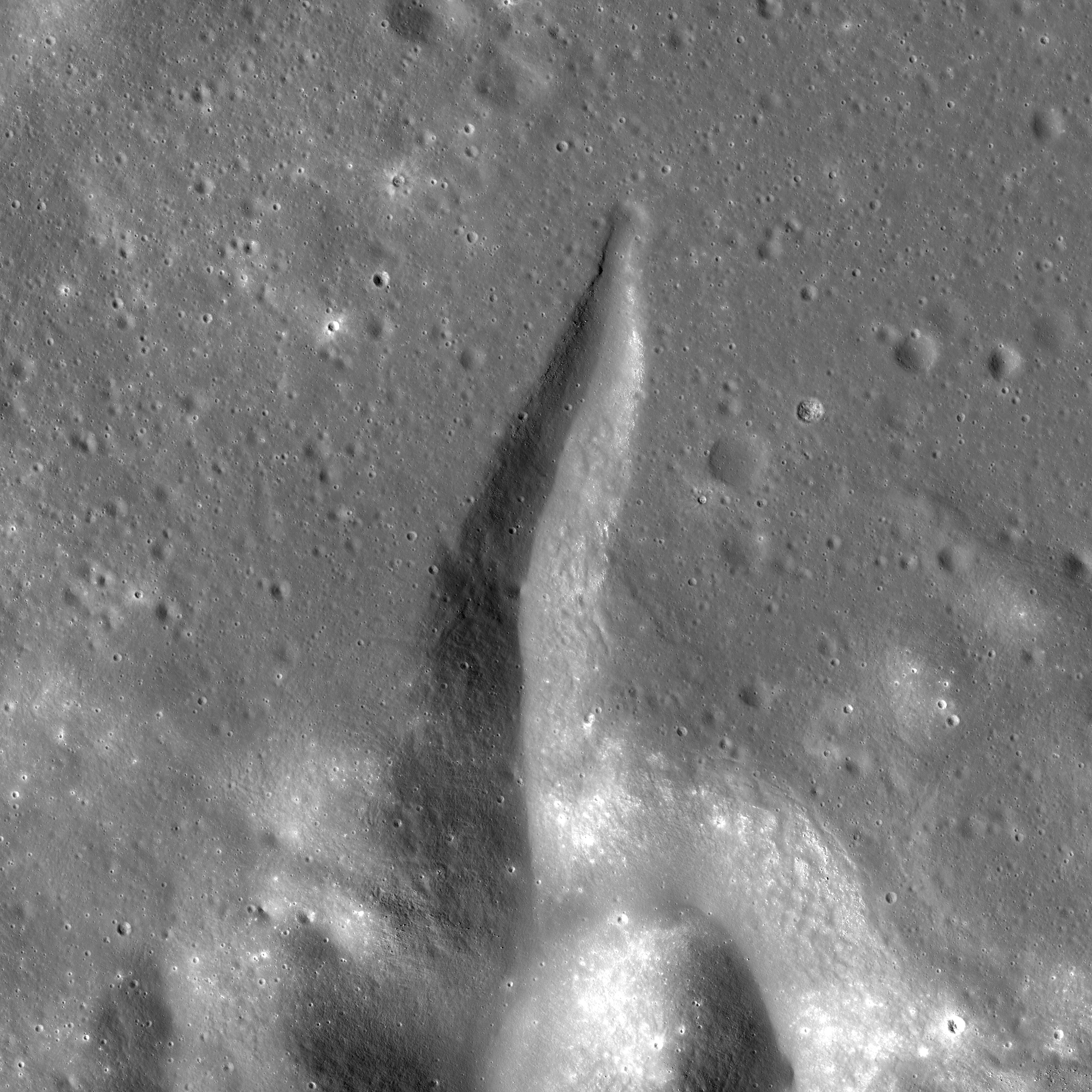
Українська: Невелика западина Карлос на Місяці, на сході Моря Дощів (карта). Координати центру — 24,92°N, 2,29°E. Знімок космічного апарату Lunar Reconnaissance Orbiter, зроблений вузькокутньою камерою (NAC) 10 серпня 2009 року з висоти 146 км. Висота Сонця — 32,6°. Розмір фото — 7×7 км, північ угорі. English: Small depression Carlos on the Moon, in eastern Mare Imbrium (a map). Centered at 24.92°N, 2.29°E. Photo by Lunar Reconnaissance Orbiter, made with Narrow Angle Camera 10 August 2009 from altitude 146 km. Sun elevation is 32.6°. Size of the photo is 7×7 km, north is up. |
| Date | |
| Source | Lunar Reconnaissance Orbiter images M104504818LE and M104504818RE. Aligned and merged manually. Resolution is decreased to reduce file size. North is up. Brightness is increased. |
| Author | NASA (photo by Lunar Reconnaissance Orbiter) |
Licensing
[edit].png&action=edit§ion=2)
| This file is in the public domain in the United States because it was solely created by NASA. NASA copyright policy states that "NASA material is not protected by copyright unless noted". (See Template:PD-USGov, NASA copyright policy page or JPL Image Use Policy.) | ||
 |
Warnings:
|
File history
Click on a date/time to view the file as it appeared at that time.
| Date/Time | Thumbnail | Dimensions | User | Comment | |
|---|---|---|---|---|---|
| current | 00:26, 3 December 2014 | | 2,000 × 2,000 (2.17 MB) | Sneeuwschaap (talk | contribs) | User created page with UploadWizard |
You cannot overwrite this file.
File usage on Commons
The following page uses this file:
File usage on other wikis
The following other wikis use this file:
- Usage on ca.wikipedia.org
- Usage on ce.wikipedia.org
- Usage on cs.wikipedia.org
- Usage on de.wikipedia.org
- Usage on es.wikipedia.org
- Usage on it.wikipedia.org
- Usage on ru.wikipedia.org
- Usage on tt.wikipedia.org
- Usage on www.wikidata.org
.png&oldid=848649888)