File:Carte France 73 découpage communal.png
Jump to navigation
Jump to search
No higher resolution available.
Carte_France_73_découpage_communal.png (645 × 524 pixels, file size: 91 KB, MIME type: image/png)
Captions
Captions
Add a one-line explanation of what this file represents
Summary[edit]
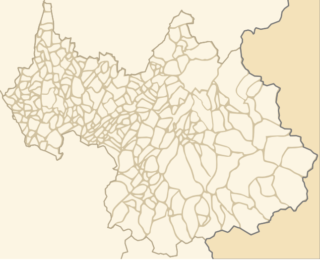
| Description | Carte du département de la Savoie avec son découpage administratif où figure les communes. |
| Date | 4 July 2008 (upload date) |
| Source | Own work |
| Author | Wikialine |
| Permission (Reusing this file) |
Cette image est une version issue d'une image créée par TomKr à l'adresse suivante http://commons.wikimedia.org/wiki/Image:Carte_France_73_A.PNG?uselang=fr |
| Other versions | http://commons.wikimedia.org/wiki/Image:Carte_France_73_A.PNG?uselang=fr |
Licensing[edit]
I, the copyright holder of this work, hereby publish it under the following licenses:

|
Permission is granted to copy, distribute and/or modify this document under the terms of the GNU Free Documentation License, Version 1.2 or any later version published by the Free Software Foundation; with no Invariant Sections, no Front-Cover Texts, and no Back-Cover Texts. A copy of the license is included in the section entitled GNU Free Documentation License. |
This file is licensed under the Creative Commons Attribution-Share Alike 3.0 Unported, 2.5 Generic, 2.0 Generic and 1.0 Generic license.
- You are free:
- to share – to copy, distribute and transmit the work
- to remix – to adapt the work
- Under the following conditions:
- attribution – You must give appropriate credit, provide a link to the license, and indicate if changes were made. You may do so in any reasonable manner, but not in any way that suggests the licensor endorses you or your use.
- share alike – If you remix, transform, or build upon the material, you must distribute your contributions under the same or compatible license as the original.
You may select the license of your choice.
File history
Click on a date/time to view the file as it appeared at that time.
| Date/Time | Thumbnail | Dimensions | User | Comment | |
|---|---|---|---|---|---|
| current | 16:46, 4 July 2008 | | 645 × 524 (91 KB) | Wikialine (talk | contribs) | {{Information |Description=Carte du département de la Savoie avec son découpage administratif où figure les communes. |Source=travail personnel |Date=04/07/2008 |Author= Wikialine |Permission= |other_versions=http://commons.wikimedia |
You cannot overwrite this file.
File usage on Commons
There are no pages that use this file.
File usage on other wikis
The following other wikis use this file:
- Usage on fr.wikipedia.org
- Discussion Projet:Communes de France/Mise en page et Esthétique
- Utilisateur:Wikisoft*/Tests cartes
- Projet:Communes de France/propositioninfobox4/Test
- Utilisateur:H du Viala/infobox
- Utilisateur:Wikisoft*/Géobox
- Discussion utilisateur:Wikisoft*/géobox2
- Discussion utilisateur:Wikisoft*/Tests cartes 1
- Discussion Wikipédia:Prise de décision/Infobox commune française/Mise en page et Esthétique
- Discussion utilisateur:TomKr/Cartographie