File:Carte commune Villars-Sainte-Croix 2014.png
Jump to navigation
Jump to search
Size of this preview: 509 × 600 pixels. Other resolutions: 204 × 240 pixels | 407 × 480 pixels | 652 × 768 pixels | 1,181 × 1,391 pixels.
Original file (1,181 × 1,391 pixels, file size: 300 KB, MIME type: image/png)
Captions
Captions
Add a one-line explanation of what this file represents
Summary
[edit]
| Description |
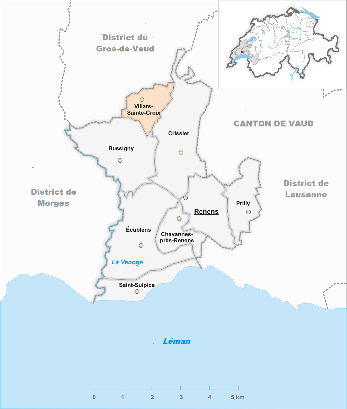
Français : Carte de la commune de Villars-Sainte-Croix dans le district de l'Ouest lausannois en français. |
| Date | |
| Source | File:Karte Gemeinde Villars-Sainte-Croix 2014.png |
| Author | Tschubby, translated by Christophe95 |
Licensing
[edit]
This file is licensed under the Creative Commons Attribution-Share Alike 3.0 Unported license.
- You are free:
- to share – to copy, distribute and transmit the work
- to remix – to adapt the work
- Under the following conditions:
- attribution – You must give appropriate credit, provide a link to the license, and indicate if changes were made. You may do so in any reasonable manner, but not in any way that suggests the licensor endorses you or your use.
- share alike – If you remix, transform, or build upon the material, you must distribute your contributions under the same or compatible license as the original.
File history
Click on a date/time to view the file as it appeared at that time.
| Date/Time | Thumbnail | Dimensions | User | Comment | |
|---|---|---|---|---|---|
| current | 20:22, 5 February 2021 | | 1,181 × 1,391 (300 KB) | Christophe95 (talk | contribs) | correct map |
| 20:01, 5 February 2021 |  | 1,181 × 1,391 (300 KB) | Christophe95 (talk | contribs) | Uploaded own work with UploadWizard |
You cannot overwrite this file.
File usage on Commons
There are no pages that use this file.
File usage on other wikis
The following other wikis use this file:
- Usage on fr.wikipedia.org
- Usage on pt.wikipedia.org