File:Carte de Sarrians.jpg
Jump to navigation
Jump to search
No higher resolution available.
Carte_de_Sarrians.jpg (300 × 300 pixels, file size: 101 KB, MIME type: image/jpeg)
Captions
Captions
Add a one-line explanation of what this file represents
Summary[edit]
| Description |
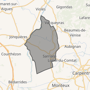
Français : Carte du territoire de la commune de Sarrians réalisé avec OpenStreetMap. |
| Date | |
| Source | https://www.openstreetmap.org/relation/184021#map=12/44.0984/4.9933 |
| Author | © les contributeurs d’OpenStreetMap |
Licensing[edit]
OpenStreetMap est sous licence Creative Commons paternité – partage à l’identique 2.0 (CC-BY-SA 2.0).[1]
This file is licensed under the Creative Commons Attribution 2.0 Generic license.
Attribution: OpenStreetMap
- You are free:
- to share – to copy, distribute and transmit the work
- to remix – to adapt the work
- Under the following conditions:
- attribution – You must give appropriate credit, provide a link to the license, and indicate if changes were made. You may do so in any reasonable manner, but not in any way that suggests the licensor endorses you or your use.
File history
Click on a date/time to view the file as it appeared at that time.
| Date/Time | Thumbnail | Dimensions | User | Comment | |
|---|---|---|---|---|---|
| current | 12:33, 6 August 2021 | | 300 × 300 (101 KB) | JyVers (talk | contribs) | Uploaded a work by © les contributeurs d’OpenStreetMap from https://www.openstreetmap.org/relation/184021#map=12/44.0984/4.9933 with UploadWizard |
You cannot overwrite this file.
File usage on Commons
There are no pages that use this file.
File usage on other wikis
The following other wikis use this file:
- Usage on fr.wikipedia.org