File:Carte du Léman.png
Jump to navigation
Jump to search
Size of this preview: 800 × 454 pixels. Other resolutions: 320 × 181 pixels | 640 × 363 pixels | 864 × 490 pixels.
Original file (864 × 490 pixels, file size: 21 KB, MIME type: image/png)
Captions
Captions
Add a one-line explanation of what this file represents
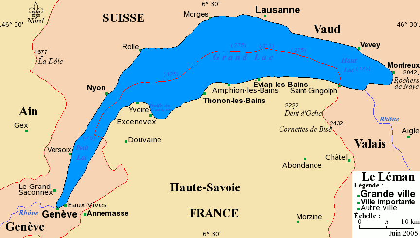
Carte du Léman avec ses villes principales.
Projection de Mercator
Fond de carte provenant de www.aquarius.geomar.de archive copy at the Wayback Machine.
Sous licence GFDL.
- Permission vous est donnée de copier, distribuer et/ou modifier ce document selon les termes de la Licence GNU Free Documentation License, Version 1.2 ou ultérieure publiée par la Free Software Foundation ; sans sections inaltérables ; sans texte de première page de couverture ; sans texte de dernière page de couverture. Une copie de cette Licence est incluse dans la section appelée GNU Free Documentation License de ce document.

|
Permission is granted to copy, distribute and/or modify this document under the terms of the GNU Free Documentation License, Version 1.2 or any later version published by the Free Software Foundation; with no Invariant Sections, no Front-Cover Texts, and no Back-Cover Texts. A copy of the license is included in the section entitled GNU Free Documentation License. |
| This file is licensed under the Creative Commons Attribution-Share Alike 3.0 Unported license. | ||
| ||
| This licensing tag was added to this file as part of the GFDL licensing update. |

|
This map image could be re-created using vector graphics as an SVG file. This has several advantages; see Commons:Media for cleanup for more information. If an SVG form of this image is available, please upload it and afterwards replace this template with
{{vector version available|new image name}}.
It is recommended to name the SVG file “Carte du Léman.svg”—then the template Vector version available (or Vva) does not need the new image name parameter. |
Copyright © juin 2005 Bra
File history
Click on a date/time to view the file as it appeared at that time.
| Date/Time | Thumbnail | Dimensions | User | Comment | |
|---|---|---|---|---|---|
| current | 20:18, 4 July 2005 | | 864 × 490 (21 KB) | Idarvol (talk | contribs) | optimisée |
| 10:04, 12 June 2005 |  | 864 × 490 (83 KB) | Idarvol (talk | contribs) | Carte du Léman avec ses villes principales. |
You cannot overwrite this file.
File usage on Commons
The following 5 pages use this file:
.png)
File usage on other wikis
The following other wikis use this file:
- Usage on de.wikipedia.org
- Usage on en.wiktionary.org
- Usage on fr.wikipedia.org
- Usage on it.wikipedia.org
- Usage on it.wikibooks.org
- Usage on mr.wikipedia.org