File:Carte géographique tramways de Rodez.svg
Jump to navigation
Jump to search

Size of this PNG preview of this SVG file: 580 × 600 pixels. Other resolutions: 232 × 240 pixels | 464 × 480 pixels | 743 × 768 pixels | 991 × 1,024 pixels | 1,981 × 2,048 pixels | 922 × 953 pixels.
Original file (SVG file, nominally 922 × 953 pixels, file size: 292 KB)
Captions
Captions
Add a one-line explanation of what this file represents
Summary[edit]
| Description |
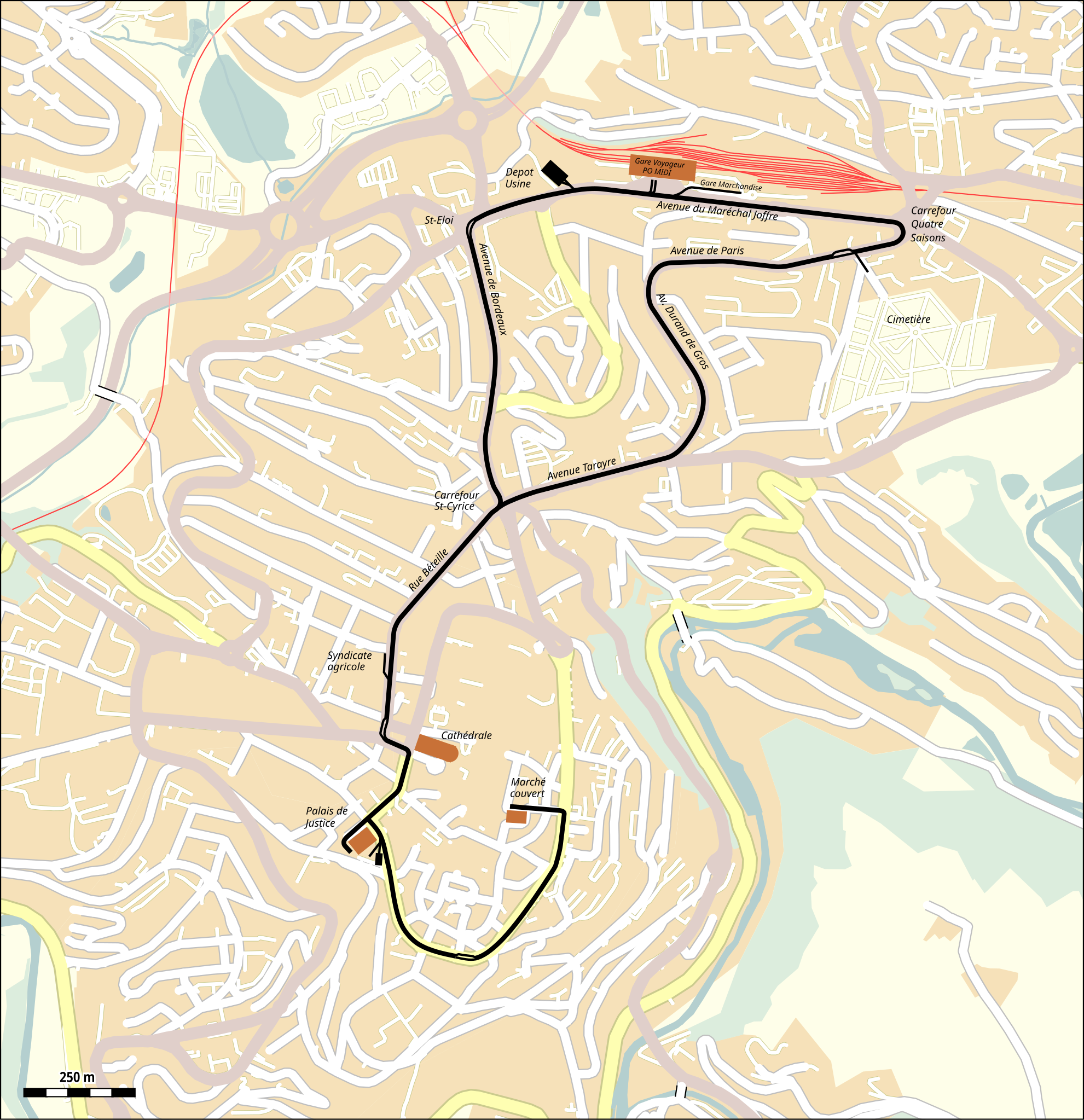
Deutsch: Verlauf der Strassenbahn in Rodez |
| Date | |
| Source |
Map was created using:
|
| Creator |
|
| Permission (Reusing this file) |
Map data (c) OpenStreetMap (and) contributors, CC-BY-SA |
Licensing[edit]
| This work is licensed under the Open Database License (summary). |
File history
Click on a date/time to view the file as it appeared at that time.
| Date/Time | Thumbnail | Dimensions | User | Comment | |
|---|---|---|---|---|---|
| current | 14:03, 2 February 2020 | | 922 × 953 (292 KB) | Pechristener (talk | contribs) | Avenue du Maréchal Joffre added |
| 09:39, 2 February 2020 |  | 922 × 953 (292 KB) | Pechristener (talk | contribs) | == {{int:filedesc}} == {{Map |Description={{de|Verlauf der Strassenbahn in Rodez}} |Source=Map was created using: * [http://www.openstreetmap.org/ Open Street Map] Data |Date=2020-02-02 |Author= * Raw data: OpenStreetMap contributers * Street car line information: [http://www.zapgillou.fr/mondalazac/articleweb/tramway-rodez.html Le tramway de Rodez] * Map rendering: Pechristener using [http://maperitive.net/ Maperitive] |Permission=Map data (c) OpenStreetMap (and) co... |
You cannot overwrite this file.
File usage on Commons
The following page uses this file:
File usage on other wikis
The following other wikis use this file:
- Usage on de.wikipedia.org
- Usage on fr.wikipedia.org
- Usage on www.wikidata.org