File:Carte itinéraire topographique, hydrographique et statistique du département du Finistère - 1849.jpg
Jump to navigation
Jump to search

Size of this preview: 699 × 600 pixels. Other resolutions: 280 × 240 pixels | 559 × 480 pixels | 895 × 768 pixels | 1,193 × 1,024 pixels | 2,386 × 2,048 pixels | 6,982 × 5,993 pixels.
Original file (6,982 × 5,993 pixels, file size: 28.66 MB, MIME type: image/jpeg)
Captions
Captions
Add a one-line explanation of what this file represents
Summary
[edit]
| Description |
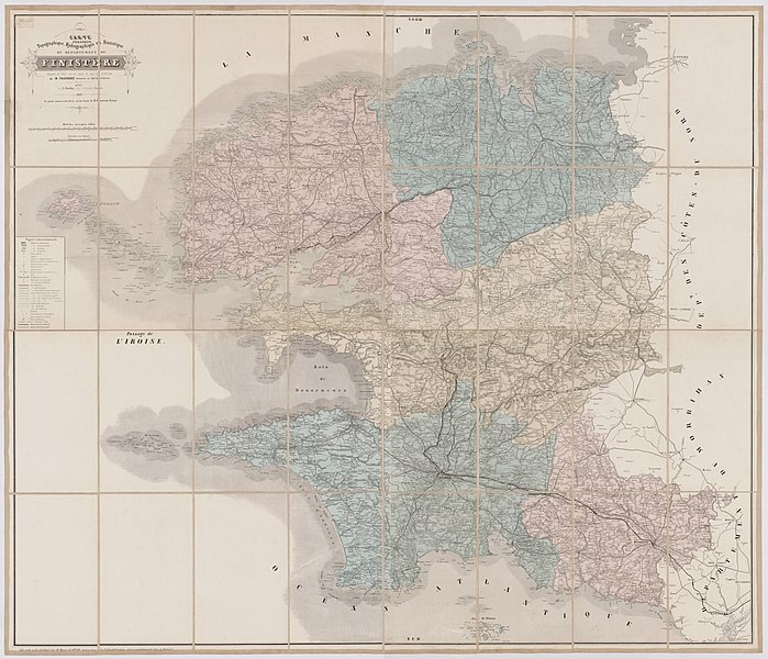
Français : Carte itinéraire topographique, hydrographique et statistique du département du Finistère |
| Date | |
| Source | https://mediatheques.quimper-bretagne-occidentale.bzh/iguana/www.main.cls?sUrl=search#recordId=1.382396 |
| Author | Taconnet |
Licensing
[edit]
|
This work is in the public domain in its country of origin and other countries and areas where the copyright term is the author's life plus 70 years or fewer. This work is in the public domain in the United States because it was published (or registered with the U.S. Copyright Office) before January 1, 1929. | |
| This file has been identified as being free of known restrictions under copyright law, including all related and neighboring rights. | |
File history
Click on a date/time to view the file as it appeared at that time.
| Date/Time | Thumbnail | Dimensions | User | Comment | |
|---|---|---|---|---|---|
| current | 14:49, 18 January 2022 | | 6,982 × 5,993 (28.66 MB) | Gz260 (talk | contribs) | Uploaded a work by Taconnet from https://mediatheques.quimper-bretagne-occidentale.bzh/iguana/www.main.cls?sUrl=search#recordId=1.382396 with UploadWizard |
You cannot overwrite this file.
File usage on Commons
There are no pages that use this file.
File usage on other wikis
The following other wikis use this file:
- Usage on fr.wikipedia.org