File:Caspian sea Ibn Hawqal.JPG
پروندهٔ اصلی (۱٬۴۳۵ × ۱٬۸۴۶ پیکسل، اندازهٔ پرونده: ۴۰۴ کیلوبایت، نوع MIME پرونده: image/jpeg)
گزینهها
عنوان
خلاصه[ویرایش]
| توضیح |
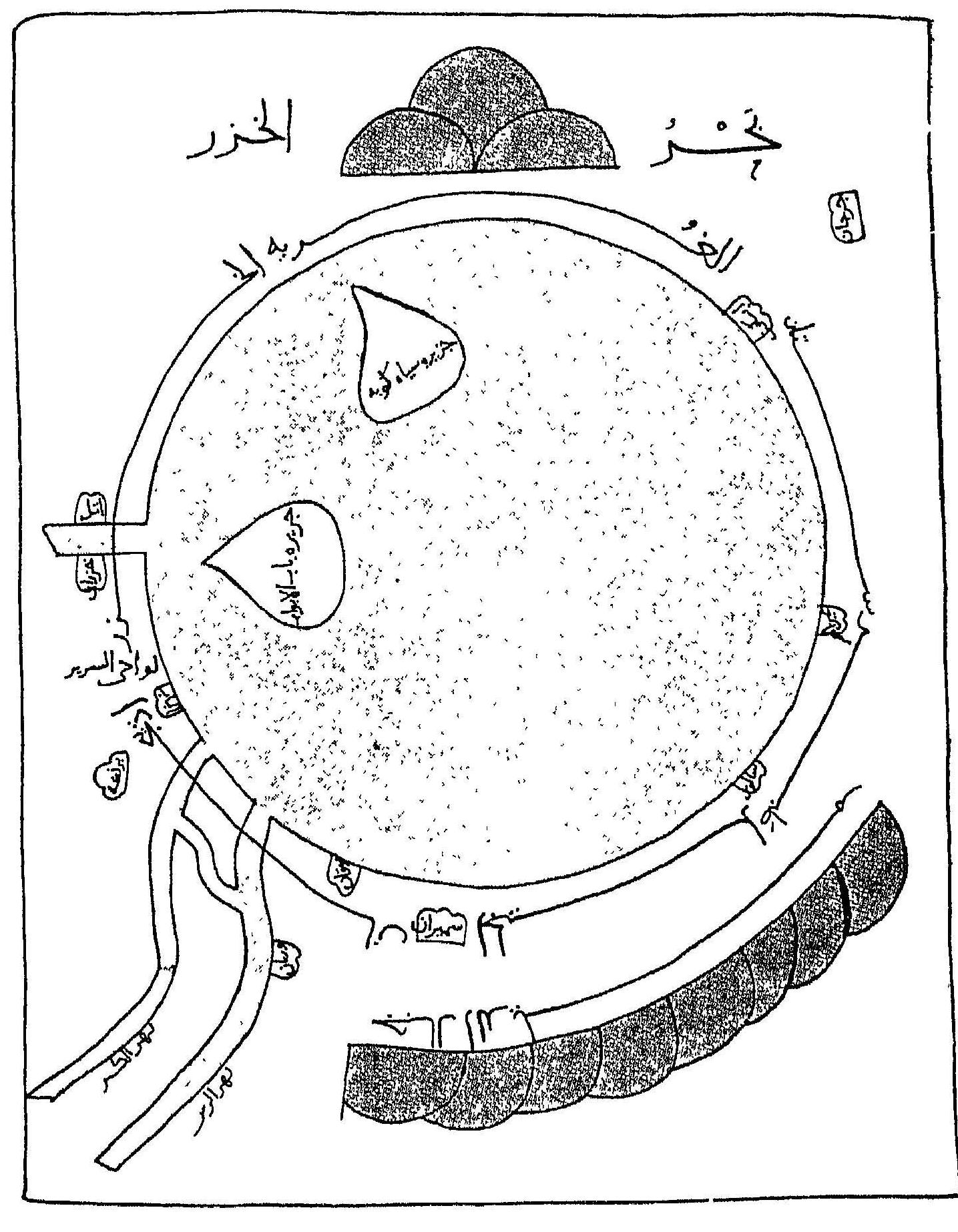
English: The Caspian sea and Azerbaijan are positioned on the right side of this 10th century map. Original map can be found in Ṣūrat al-’Arḍ (صورة الارض; "The face of the Earth") by Ibn Hawqal (977), Beirut, page 419 |
| تاریخ | |
| منبع | Ṣūrat al-’Arḍ (صورة الارض; "The face of the Earth") by Ibn Hawqal (977), Beirut, page 419 |
| پدیدآور | Ibn Hawqal |
اجازهنامه[ویرایش]
|
این اثر در کشورهایی و مناطقی که مدت زمان حق تکثیر، عمر پدیدآورنده بعلاوه 70 سال یا کمتر بعد از مرگ او است، در مالکیت عمومی قرار دارد.
| |
| این پرونده تحت قانون حق تکثیر محدودیت آزاد منتشر شده که شامل تمامی حقوق مربوطه و حقوق نزدیک به آن میشود. | |
تاریخچهٔ پرونده
روی تاریخ/زمانها کلیک کنید تا نسخهٔ مربوط به آن هنگام را ببینید.
| تاریخ/زمان | بندانگشتی | ابعاد | کاربر | توضیح | |
|---|---|---|---|---|---|
| کنونی | ۱۴ فوریهٔ ۲۰۱۲، ساعت ۰۷:۴۰ | | ۱٬۴۳۵ در ۱٬۸۴۶ (۴۰۴ کیلوبایت) | Ebrahimi-amir (بحث | مشارکتها) |
شما نمیتوانید این پرونده را رونویسی کنید.
کاربرد پرونده
این پرونده در هیچ صفحهای به کار نرفته است.
کاربرد سراسری پرونده
ویکیهای دیگر زیر از این پرونده استفاده میکنند:
- کاربرد در azb.wikipedia.org
- کاربرد در az.wikipedia.org
- کاربرد در en.wikipedia.org
- کاربرد در es.wikipedia.org
- کاربرد در fa.wikipedia.org
- کاربرد در fa.wikibooks.org
- کاربرد در gl.wikipedia.org
- کاربرد در ilo.wikipedia.org
- کاربرد در it.wikipedia.org
- کاربرد در su.wikipedia.org
- کاربرد در ta.wikipedia.org
- کاربرد در tr.wikipedia.org
- کاربرد در zh.wikipedia.org