File:Casta-MAP Guadalcanal.jpg
- Fichier
- Historique du fichier
- Utilisations locales du fichier
- Utilisations du fichier sur d’autres wikis
- Métadonnées
Casta-MAP_Guadalcanal.jpg (538 × 452 pixels, taille du fichier : 52 kio, type MIME : image/jpeg)
Légendes
Légendes
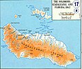
Guadalcanal Island.
According to the University of Texas, "most of the maps scanned by the University of Texas Libraries and served from this web site are in the public domain. No permissions are needed to copy them. You may download them and use them as you wish. A few maps are copyrighted, and are clearly marked as such.". As the image, when downloaded from here was no tagged, the map is PD.
| Public domainPublic domainfalsefalse |
Ce fichier est dans le domaine public, parce que it was put in PD by the University of Texas (from the Perry-Castaneda Library Map Collection hosted by http://www.lib.utexas.edu/maps/ - see above)
Si cela n'est pas légalement possible : Veuillez vérifier que la raison donnée est compatible avec la politique de licences de Commons.
|
Historique du fichier
Cliquer sur une date et heure pour voir le fichier tel qu'il était à ce moment-là.
| Date et heure | Vignette | Dimensions | Utilisateur | Commentaire | |
|---|---|---|---|---|---|
| actuel | 6 novembre 2010 à 20:44 |  | 538 × 452 (52 kio) | Hohum (d | contributions) | Cleaned |
| 11 août 2005 à 20:32 |  | 538 × 452 (38 kio) | Bradipus (d | contributions) | Guadalcanal Island. Maps from http://www.lib.utexas.edu/maps/ Public Domain (see http://navalhistory.flixco.info/H/118421x19817/8330/a0.htm) {{PD}} |
Vous ne pouvez pas remplacer ce fichier.
Utilisations locales du fichier
Les 15 pages suivantes utilisent ce fichier :
- Actions along the Matanikau (September – October 1942)
- Battle for Henderson Field
- Battle of Edson's Ridge
- Battle of the Tenaru
- Cactus Air Force
- Carlson's Patrol
- Guadalcanal Campaign
- Invasion of Tulagi (May 1942)
- Solomon Islands campaign
- File:Casta-MAP Guadalcanal.png
- File:Casta-MAP Guadalcanal - it.jpg
- File:Guadalcanal & Florida Island map - fr.svg
- File:Guadalcanal & Florida Island map - mk.svg
- File:Solomon island - Guadalcanal - Florida map-ru.svg
- File:Solomon island - Guadalcanal - Florida map - en.svg
Utilisations du fichier sur d’autres wikis
Les autres wikis suivants utilisent ce fichier :
- Utilisation sur ca.wikipedia.org
- Utilisation sur da.wikipedia.org
- Utilisation sur de.wikipedia.org
- Utilisation sur en.wikipedia.org
- Utilisation sur fr.wikipedia.org
- Utilisation sur he.wikipedia.org
- Utilisation sur id.wikipedia.org
- Utilisation sur it.wikipedia.org
- Utilisation sur pt.wikipedia.org
- Utilisation sur ro.wikipedia.org
- Utilisation sur ru.wikipedia.org
- Utilisation sur uk.wikipedia.org
Métadonnées
Ce fichier contient des informations supplémentaires, probablement ajoutées par l'appareil photo numérique ou le numériseur utilisé pour le créer.
Si le fichier a été modifié depuis son état original, certains détails peuvent ne pas refléter entièrement l'image modifiée.
| _error | 0 |
|---|
